CHM KN.CHM - Earthquake Result Viewer
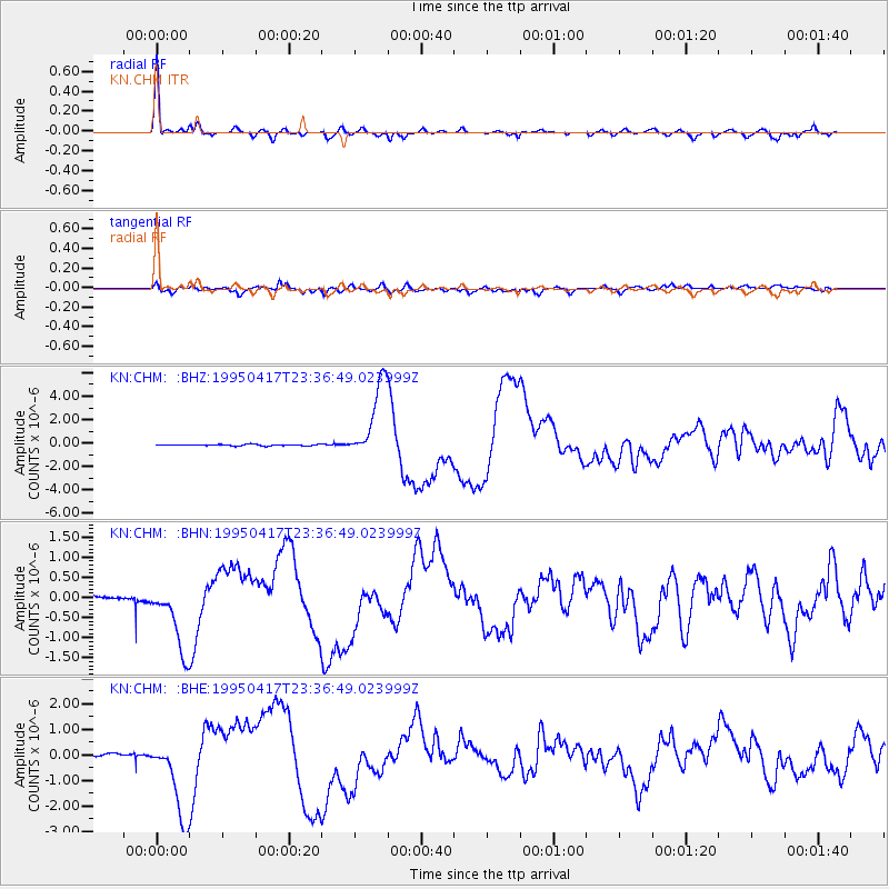
Earthquake location: Kuril Islands
Earthquake latitude/longitude: 45.9/151.3
Earthquake time(UTC): 1995/04/17 (107) 23:28:08 GMT
Earthquake Depth: 34 km
Earthquake Magnitude: 6.1 MB, 6.3 MS, 6.2 UNKNOWN, 6.8 MW
Earthquake Catalog/Contributor: WHDF/NEIC
Network: KN Kyrgyz Seismic Telemetry Network
Station: CHM KN.CHM
Lat/Lon: 43.00 N/74.75 E
Elevation: 655 m
Distance: 52.7 deg
Az: 296.274 deg
Baz: 58.588 deg
Ray Param: 0.06651477
Estimated Moho Depth: 45.75 km
Estimated Crust Vp/Vs: 1.84
Assumed Crust Vp: 6.306 km/s
Estimated Crust Vs: 3.432 km/s
Estimated Crust Poisson's Ratio: 0.29
Radial Match: 97.01633 %
Radial Bump: 331
Transverse Match: 81.95364 %
Transverse Bump: 400
SOD ConfigId: 6273
Insert Time: 2010-03-08 19:25:58.893 +0000
GWidth: 2.5
Max Bumps: 400
Tol: 0.001

Signal To Noise

ChannelStoNSTALTA
KN:CHM: :BHN:19950417T23:36:49.023999Z5.9935661.034935E-61.7267435E-7
KN:CHM: :BHE:19950417T23:36:49.023999Z39.6443861.5680233E-63.9552216E-8
KN:CHM: :BHZ:19950417T23:36:49.023999Z57.1162763.3282577E-65.8271617E-8
Arrivals
Ps6.4 SECOND
PpPs20 SECOND
PsPs/PpSs26 SECOND