
CHM KN.CHM - Earthquake Result Viewer
| ||||||||||||||||||
| ||||||||||||||||||
| ||||||||||||||||||
|
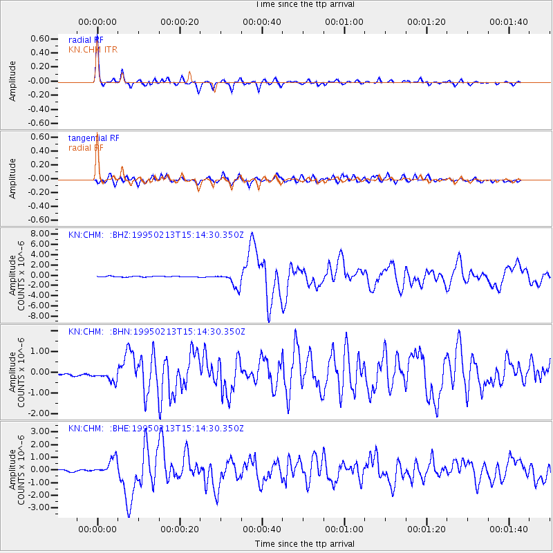
Signal To Noise
| Channel | StoN | STA | LTA |
| KN:CHM: :BHN:19950213T15:14:30.350Z | 1.8863894 | 4.7677855E-7 | 2.5274662E-7 |
| KN:CHM: :BHE:19950213T15:14:30.350Z | 7.151173 | 6.242342E-7 | 8.7291156E-8 |
| KN:CHM: :BHZ:19950213T15:14:30.350Z | 16.834238 | 1.4949215E-6 | 8.880245E-8 |
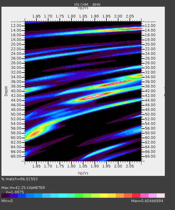
| Arrivals | |
| Ps | 6.2 SECOND |
| PpPs | 19 SECOND |
| PsPs/PpSs | 25 SECOND |

