You are here: Home > Network List > TA - USArray Transportable Network (new EarthScope stations) Stations List
> Station F31M Tsiigehtchic, NWT, CAN > Earthquake Result Viewer
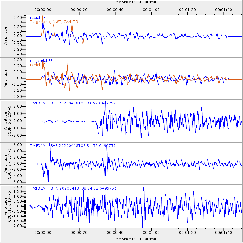
F31M Tsiigehtchic, NWT, CAN - Earthquake Result Viewer
*The percent match for this event was below the threshold and hence no stack was calculated.
| Earthquake location: |
Bonin Islands, Japan Region |
| Earthquake latitude/longitude: |
27.1/140.1 |
| Earthquake time(UTC): |
2020/04/18 (109) 08:25:37 GMT |
| Earthquake Depth: |
454 km |
| Earthquake Magnitude: |
6.6 Mww |
| Earthquake Catalog/Contributor: |
NEIC PDE/us |
|
| Network: |
TA USArray Transportable Network (new EarthScope stations) |
| Station: |
F31M Tsiigehtchic, NWT, CAN |
| Lat/Lon: |
67.44 N/133.74 W |
| Elevation: |
56 m |
|
| Distance: |
63.8 deg |
| Az: |
25.41 deg |
| Baz: |
277.68 deg |
| Ray Param: |
$rayparam |
*The percent match for this event was below the threshold and hence was not used in the summary stack. |
|
| Radial Match: |
73.486786 % |
| Radial Bump: |
400 |
| Transverse Match: |
71.31453 % |
| Transverse Bump: |
400 |
| SOD ConfigId: |
21166931 |
| Insert Time: |
2020-05-02 08:48:54.947 +0000 |
| GWidth: |
2.5 |
| Max Bumps: |
400 |
| Tol: |
0.001 |
|
Signal To Noise
| Channel | StoN | STA | LTA |
| TA:F31M: :BHZ:20200418T08:34:52.649975Z | 38.566906 | 3.103997E-6 | 8.048343E-8 |
| TA:F31M: :BHN:20200418T08:34:52.649975Z | 2.6963415 | 3.5399384E-7 | 1.3128671E-7 |
| TA:F31M: :BHE:20200418T08:34:52.649975Z | 16.11729 | 1.2398431E-6 | 7.692627E-8 |
| Arrivals |
| Ps | |
| PpPs | |
| PsPs/PpSs | |


