You are here: Home > Network List > TA - USArray Transportable Network (new EarthScope stations) Stations List
> Station G31M Satah River, YT, CAN > Earthquake Result Viewer
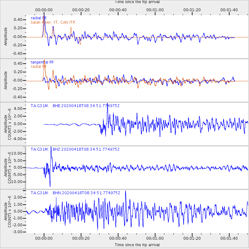
G31M Satah River, YT, CAN - Earthquake Result Viewer
*The percent match for this event was below the threshold and hence no stack was calculated.
| Earthquake location: |
Bonin Islands, Japan Region |
| Earthquake latitude/longitude: |
27.1/140.1 |
| Earthquake time(UTC): |
2020/04/18 (109) 08:25:37 GMT |
| Earthquake Depth: |
454 km |
| Earthquake Magnitude: |
6.6 Mww |
| Earthquake Catalog/Contributor: |
NEIC PDE/us |
|
| Network: |
TA USArray Transportable Network (new EarthScope stations) |
| Station: |
G31M Satah River, YT, CAN |
| Lat/Lon: |
66.92 N/134.27 W |
| Elevation: |
61 m |
|
| Distance: |
63.7 deg |
| Az: |
26.016 deg |
| Baz: |
277.461 deg |
| Ray Param: |
$rayparam |
*The percent match for this event was below the threshold and hence was not used in the summary stack. |
|
| Radial Match: |
75.99136 % |
| Radial Bump: |
400 |
| Transverse Match: |
77.18602 % |
| Transverse Bump: |
400 |
| SOD ConfigId: |
21166931 |
| Insert Time: |
2020-05-02 08:49:13.615 +0000 |
| GWidth: |
2.5 |
| Max Bumps: |
400 |
| Tol: |
0.001 |
|
Signal To Noise
| Channel | StoN | STA | LTA |
| TA:G31M: :BHZ:20200418T08:34:51.774975Z | 55.789066 | 5.5996234E-6 | 1.0037134E-7 |
| TA:G31M: :BHN:20200418T08:34:51.774975Z | 3.0557337 | 4.7095233E-7 | 1.5412085E-7 |
| TA:G31M: :BHE:20200418T08:34:51.774975Z | 13.128554 | 1.7719753E-6 | 1.349711E-7 |
| Arrivals |
| Ps | |
| PpPs | |
| PsPs/PpSs | |


