CHM KN.CHM - Earthquake Result Viewer
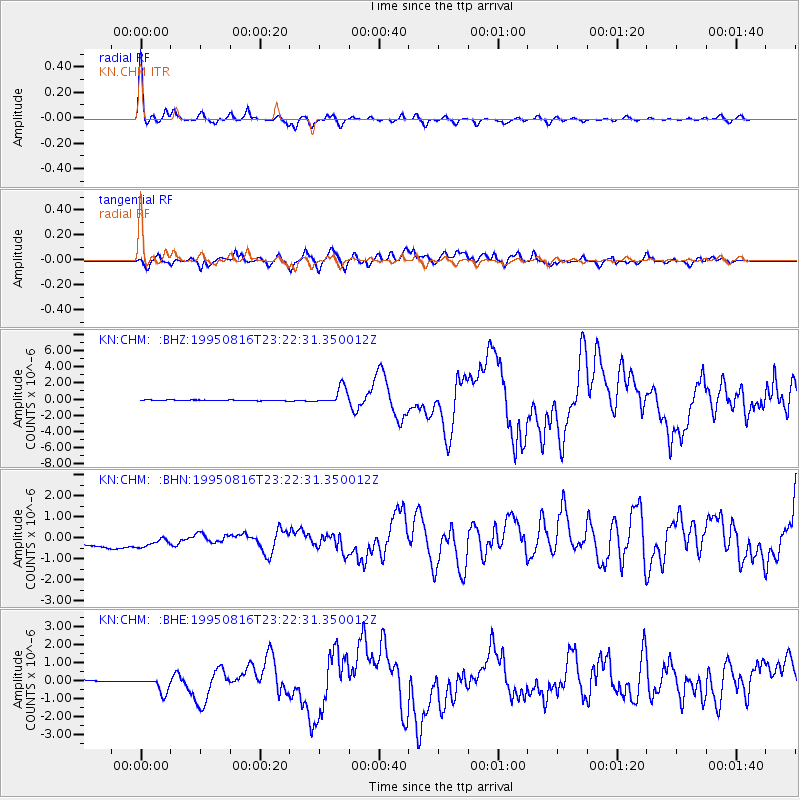
Earthquake location: Solomon Islands
Earthquake latitude/longitude: -5.8/154.3
Earthquake time(UTC): 1995/08/16 (228) 23:10:28 GMT
Earthquake Depth: 74 km
Earthquake Magnitude: 6.1 MB, 7.2 MS, 7.2 UNKNOWN, 7.2 MW
Earthquake Catalog/Contributor: WHDF/NEIC
Network: KN Kyrgyz Seismic Telemetry Network
Station: CHM KN.CHM
Lat/Lon: 43.00 N/74.75 E
Elevation: 655 m
Distance: 86.3 deg
Az: 313.705 deg
Baz: 101.361 deg
Ray Param: 0.04402574
Estimated Moho Depth: 57.25 km
Estimated Crust Vp/Vs: 1.61
Assumed Crust Vp: 6.306 km/s
Estimated Crust Vs: 3.917 km/s
Estimated Crust Poisson's Ratio: 0.19
Radial Match: 97.22864 %
Radial Bump: 276
Transverse Match: 68.59062 %
Transverse Bump: 400
SOD ConfigId: 6273
Insert Time: 2010-03-08 19:26:38.141 +0000
GWidth: 2.5
Max Bumps: 400
Tol: 0.001

Signal To Noise

ChannelStoNSTALTA
KN:CHM: :BHN:19950816T23:22:31.350012Z0.9233827.4037195E-78.018046E-7
KN:CHM: :BHE:19950816T23:22:31.350012Z3.11698035.508606E-71.7672893E-7
KN:CHM: :BHZ:19950816T23:22:31.350012Z23.5904061.0569654E-64.480488E-8
Arrivals
Ps5.7 SECOND
PpPs23 SECOND
PsPs/PpSs29 SECOND