You are here: Home > Network List > TS - TERRAscope (Southern California Seismic Network) Stations List
> Station SBC Santa Barbara, California, USA > Earthquake Result Viewer
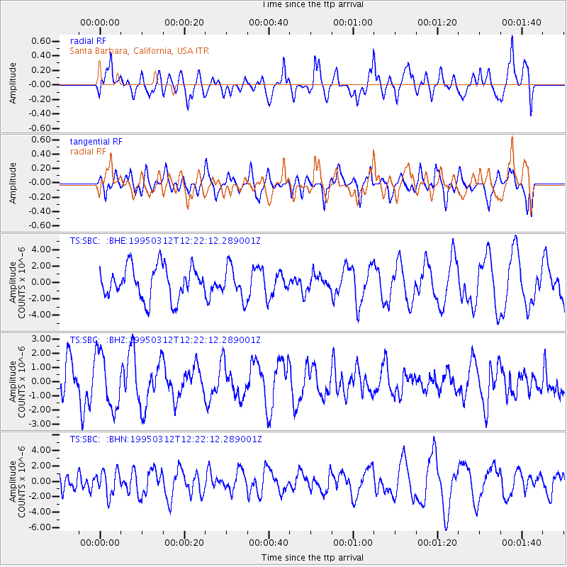
SBC Santa Barbara, California, USA - Earthquake Result Viewer
*The percent match for this event was below the threshold and hence no stack was calculated.
| Earthquake location: |
Eastern New Guinea Reg., P.N.G. |
| Earthquake latitude/longitude: |
-5.3/146.7 |
| Earthquake time(UTC): |
1995/03/12 (071) 12:09:43 GMT |
| Earthquake Depth: |
233 km |
| Earthquake Magnitude: |
5.6 MB, 6.2 UNKNOWN, 6.1 MW |
| Earthquake Catalog/Contributor: |
WHDF/NEIC |
|
| Network: |
TS TERRAscope (Southern California Seismic Network) |
| Station: |
SBC Santa Barbara, California, USA |
| Lat/Lon: |
34.44 N/119.71 W |
| Elevation: |
90 m |
|
| Distance: |
95.9 deg |
| Az: |
56.027 deg |
| Baz: |
267.629 deg |
| Ray Param: |
$rayparam |
*The percent match for this event was below the threshold and hence was not used in the summary stack. |
|
| Radial Match: |
65.90401 % |
| Radial Bump: |
400 |
| Transverse Match: |
59.49418 % |
| Transverse Bump: |
400 |
| SOD ConfigId: |
4480 |
| Insert Time: |
2010-02-26 14:47:54.311 +0000 |
| GWidth: |
2.5 |
| Max Bumps: |
400 |
| Tol: |
0.001 |
|
Signal To Noise
| Channel | StoN | STA | LTA |
| TS:SBC: :BHZ:19950312T12:22:12.289001Z | 2.4776115 | 1.9576266E-6 | 7.9012653E-7 |
| TS:SBC: :BHN:19950312T12:22:12.289001Z | 1.5501865 | 1.5953167E-6 | 1.0291127E-6 |
| TS:SBC: :BHE:19950312T12:22:12.289001Z | 1.0281471 | 1.9886495E-6 | 1.9342074E-6 |
| Arrivals |
| Ps | |
| PpPs | |
| PsPs/PpSs | |


