CHM KN.CHM - Earthquake Result Viewer
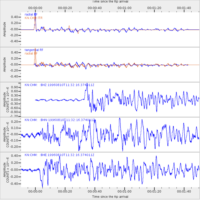
Earthquake location: New Britain Region, P.N.G.
Earthquake latitude/longitude: -4.9/152.1
Earthquake time(UTC): 1996/08/10 (223) 11:20:19 GMT
Earthquake Depth: 33 km
Earthquake Magnitude: 5.6 MB, 6.0 MS, 6.2 UNKNOWN, 6.1 MW
Earthquake Catalog/Contributor: WHDF/NEIC
Network: KN Kyrgyz Seismic Telemetry Network
Station: CHM KN.CHM
Lat/Lon: 43.00 N/74.75 E
Elevation: 655 m
Distance: 84.2 deg
Az: 313.974 deg
Baz: 102.225 deg
Ray Param: 0.045630284
Estimated Moho Depth: 31.5 km
Estimated Crust Vp/Vs: 2.04
Assumed Crust Vp: 6.306 km/s
Estimated Crust Vs: 3.091 km/s
Estimated Crust Poisson's Ratio: 0.34
Radial Match: 96.25856 %
Radial Bump: 311
Transverse Match: 86.70725 %
Transverse Bump: 400
SOD ConfigId: 6273
Insert Time: 2010-03-08 19:27:16.843 +0000
GWidth: 2.5
Max Bumps: 400
Tol: 0.001

Signal To Noise

ChannelStoNSTALTA
KN:CHM: :BHN:19960810T11:32:16.374011Z1.83866173.7104023E-82.0179908E-8
KN:CHM: :BHE:19960810T11:32:16.374011Z8.9366921.7360757E-71.9426379E-8
KN:CHM: :BHZ:19960810T11:32:16.374011Z13.1619684.2994944E-73.2666044E-8
Arrivals
Ps5.3 SECOND
PpPs15 SECOND
PsPs/PpSs20 SECOND