You are here: Home > Network List > US - United States National Seismic Network Stations List
> Station AMTX Amarillo, Texas, USA > Earthquake Result Viewer
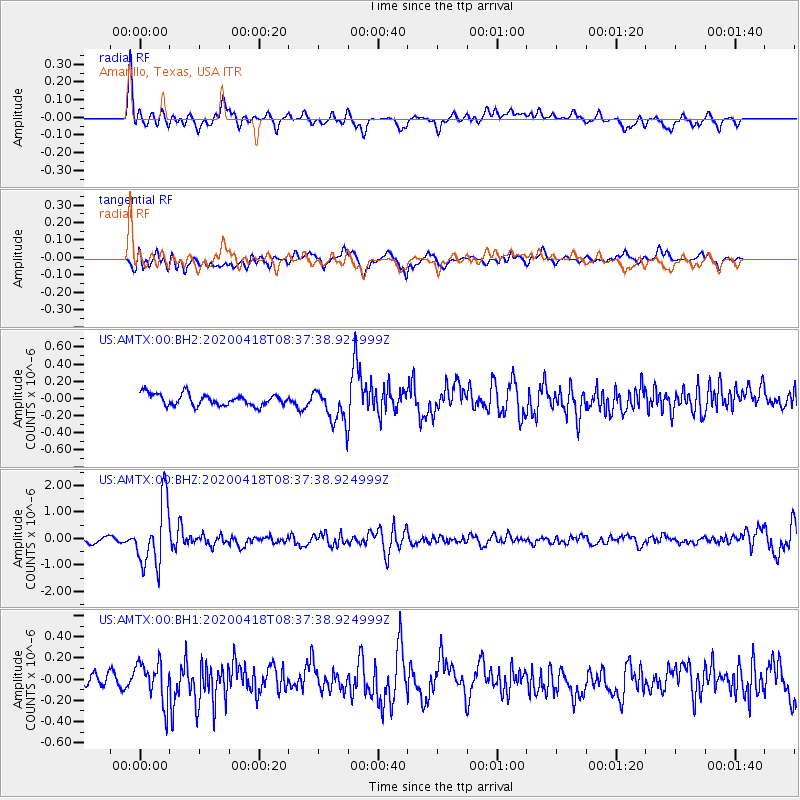
AMTX Amarillo, Texas, USA - Earthquake Result Viewer
*The percent match for this event was below the threshold and hence no stack was calculated.
| Earthquake location: |
Bonin Islands, Japan Region |
| Earthquake latitude/longitude: |
27.1/140.1 |
| Earthquake time(UTC): |
2020/04/18 (109) 08:25:37 GMT |
| Earthquake Depth: |
454 km |
| Earthquake Magnitude: |
6.6 Mww |
| Earthquake Catalog/Contributor: |
NEIC PDE/us |
|
| Network: |
US United States National Seismic Network |
| Station: |
AMTX Amarillo, Texas, USA |
| Lat/Lon: |
34.53 N/101.41 W |
| Elevation: |
1010 m |
|
| Distance: |
95.4 deg |
| Az: |
46.797 deg |
| Baz: |
308.112 deg |
| Ray Param: |
$rayparam |
*The percent match for this event was below the threshold and hence was not used in the summary stack. |
|
| Radial Match: |
65.64828 % |
| Radial Bump: |
400 |
| Transverse Match: |
67.19637 % |
| Transverse Bump: |
400 |
| SOD ConfigId: |
21166931 |
| Insert Time: |
2020-05-02 08:52:55.437 +0000 |
| GWidth: |
2.5 |
| Max Bumps: |
400 |
| Tol: |
0.001 |
|
Signal To Noise
| Channel | StoN | STA | LTA |
| US:AMTX:00:BHZ:20200418T08:37:38.924999Z | 16.39187 | 1.2112488E-6 | 7.389326E-8 |
| US:AMTX:00:BH1:20200418T08:37:38.924999Z | 2.258438 | 1.9030867E-7 | 8.426561E-8 |
| US:AMTX:00:BH2:20200418T08:37:38.924999Z | 5.1497736 | 3.1226813E-7 | 6.0637255E-8 |
| Arrivals |
| Ps | |
| PpPs | |
| PsPs/PpSs | |


