You are here: Home > Network List > US - United States National Seismic Network Stations List
> Station CBKS Cedar Bluff, Kansas, USA > Earthquake Result Viewer
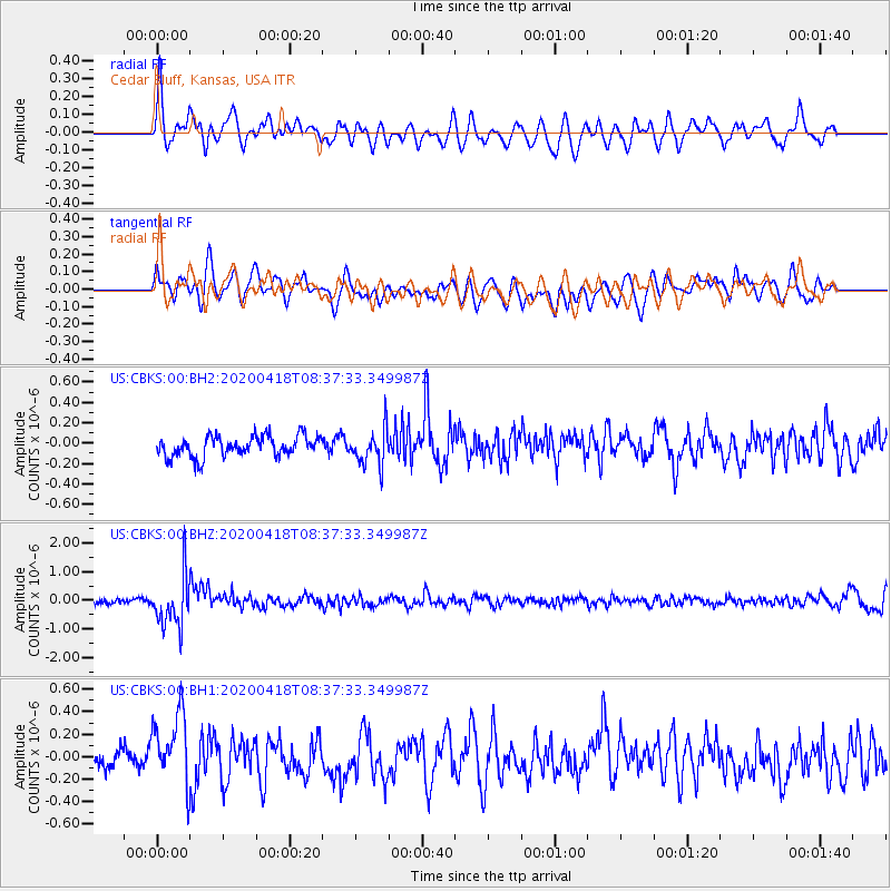
CBKS Cedar Bluff, Kansas, USA - Earthquake Result Viewer
*The percent match for this event was below the threshold and hence no stack was calculated.
| Earthquake location: |
Bonin Islands, Japan Region |
| Earthquake latitude/longitude: |
27.1/140.1 |
| Earthquake time(UTC): |
2020/04/18 (109) 08:25:37 GMT |
| Earthquake Depth: |
454 km |
| Earthquake Magnitude: |
6.6 Mww |
| Earthquake Catalog/Contributor: |
NEIC PDE/us |
|
| Network: |
US United States National Seismic Network |
| Station: |
CBKS Cedar Bluff, Kansas, USA |
| Lat/Lon: |
38.81 N/99.74 W |
| Elevation: |
677 m |
|
| Distance: |
93.8 deg |
| Az: |
42.61 deg |
| Baz: |
309.445 deg |
| Ray Param: |
$rayparam |
*The percent match for this event was below the threshold and hence was not used in the summary stack. |
|
| Radial Match: |
58.7396 % |
| Radial Bump: |
400 |
| Transverse Match: |
56.63476 % |
| Transverse Bump: |
400 |
| SOD ConfigId: |
21166931 |
| Insert Time: |
2020-05-02 08:53:01.300 +0000 |
| GWidth: |
2.5 |
| Max Bumps: |
400 |
| Tol: |
0.001 |
|
Signal To Noise
| Channel | StoN | STA | LTA |
| US:CBKS:00:BHZ:20200418T08:37:33.349987Z | 11.474656 | 8.777802E-7 | 7.64973E-8 |
| US:CBKS:00:BH1:20200418T08:37:33.349987Z | 3.263472 | 3.2923873E-7 | 1.0088603E-7 |
| US:CBKS:00:BH2:20200418T08:37:33.349987Z | 1.7918884 | 1.8183691E-7 | 1.01477816E-7 |
| Arrivals |
| Ps | |
| PpPs | |
| PsPs/PpSs | |


