You are here: Home > Network List > UU - University of Utah Regional Network Stations List
> Station KNB Kanab, UT, USA > Earthquake Result Viewer
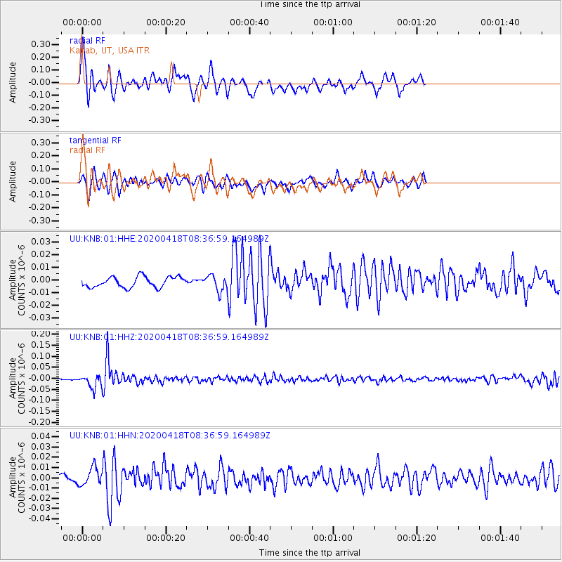
KNB Kanab, UT, USA - Earthquake Result Viewer
*The percent match for this event was below the threshold and hence no stack was calculated.
| Earthquake location: |
Bonin Islands, Japan Region |
| Earthquake latitude/longitude: |
27.1/140.1 |
| Earthquake time(UTC): |
2020/04/18 (109) 08:25:37 GMT |
| Earthquake Depth: |
454 km |
| Earthquake Magnitude: |
6.6 Mww |
| Earthquake Catalog/Contributor: |
NEIC PDE/us |
|
| Network: |
UU University of Utah Regional Network |
| Station: |
KNB Kanab, UT, USA |
| Lat/Lon: |
37.02 N/112.82 W |
| Elevation: |
1715 m |
|
| Distance: |
86.4 deg |
| Az: |
50.053 deg |
| Baz: |
301.401 deg |
| Ray Param: |
$rayparam |
*The percent match for this event was below the threshold and hence was not used in the summary stack. |
|
| Radial Match: |
75.497925 % |
| Radial Bump: |
396 |
| Transverse Match: |
74.50936 % |
| Transverse Bump: |
400 |
| SOD ConfigId: |
21166931 |
| Insert Time: |
2020-05-02 08:54:00.504 +0000 |
| GWidth: |
2.5 |
| Max Bumps: |
400 |
| Tol: |
0.001 |
|
Signal To Noise
| Channel | StoN | STA | LTA |
| UU:KNB:01:HHZ:20200418T08:36:59.164989Z | 7.0263524 | 3.0495123E-8 | 4.3401074E-9 |
| UU:KNB:01:HHN:20200418T08:36:59.164989Z | 1.6880553 | 8.665545E-9 | 5.1334488E-9 |
| UU:KNB:01:HHE:20200418T08:36:59.164989Z | 1.543927 | 6.4368284E-9 | 4.1691277E-9 |
| Arrivals |
| Ps | |
| PpPs | |
| PsPs/PpSs | |


