
CHM KN.CHM - Earthquake Result Viewer
| ||||||||||||||||||
| ||||||||||||||||||
| ||||||||||||||||||
|
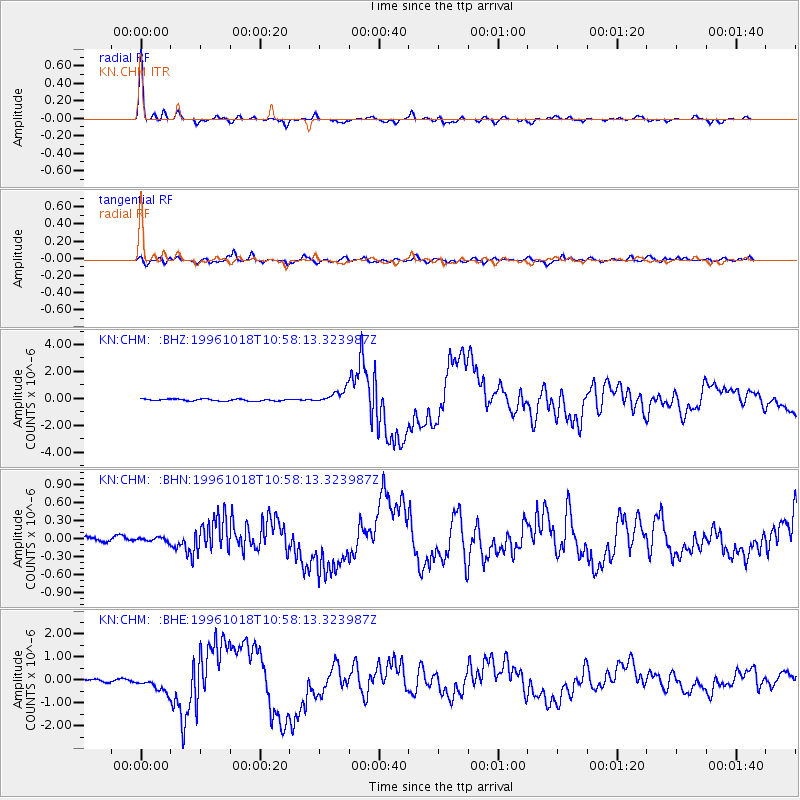
Signal To Noise
| Channel | StoN | STA | LTA |
| KN:CHM: :BHN:19961018T10:58:13.323987Z | 0.5604529 | 3.099211E-8 | 5.5298326E-8 |
| KN:CHM: :BHE:19961018T10:58:13.323987Z | 6.4309273 | 3.298031E-7 | 5.128391E-8 |
| KN:CHM: :BHZ:19961018T10:58:13.323987Z | 7.2458467 | 5.1113716E-7 | 7.0542086E-8 |
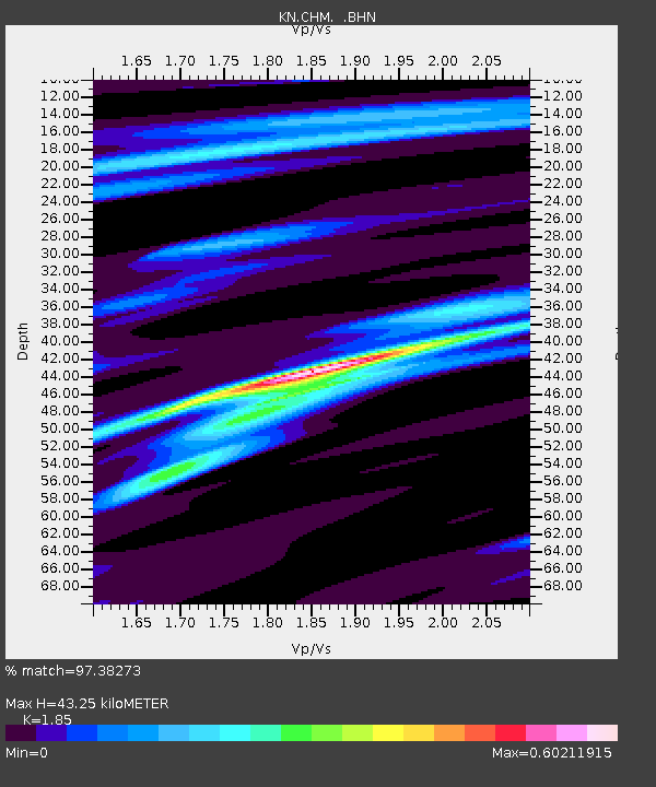
| Arrivals | |
| Ps | 6.2 SECOND |
| PpPs | 18 SECOND |
| PsPs/PpSs | 25 SECOND |

