You are here: Home > Network List > IW - Intermountain West Stations List
> Station MOOW Moose Ponds, Wyoming, USA > Earthquake Result Viewer
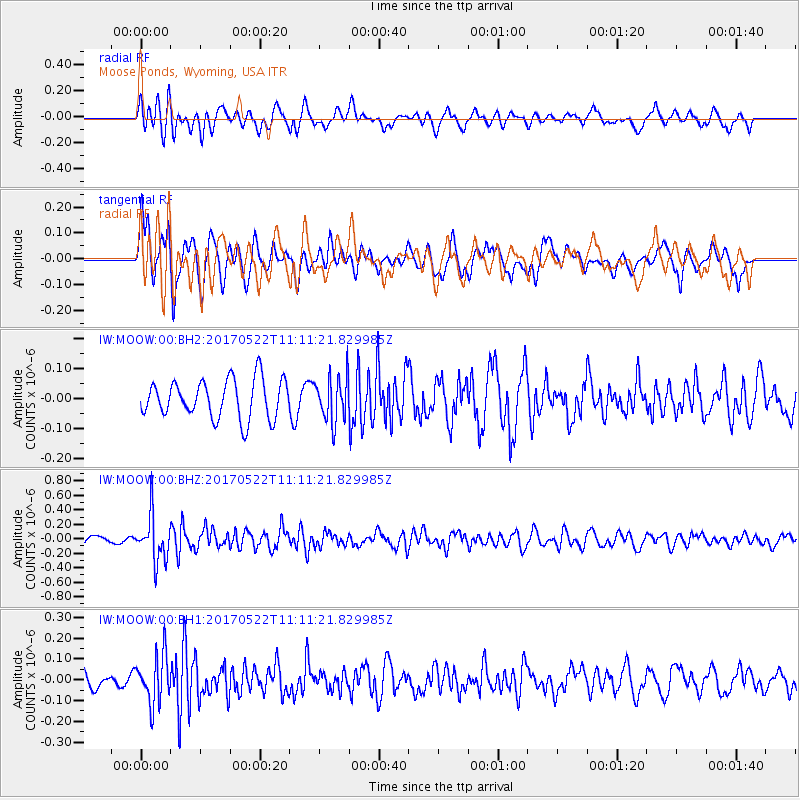
MOOW Moose Ponds, Wyoming, USA - Earthquake Result Viewer
*The percent match for this event was below the threshold and hence no stack was calculated.
| Earthquake location: |
Kuril Islands |
| Earthquake latitude/longitude: |
43.9/147.7 |
| Earthquake time(UTC): |
2017/05/22 (142) 11:00:57 GMT |
| Earthquake Depth: |
54 km |
| Earthquake Magnitude: |
5.5 Mww |
| Earthquake Catalog/Contributor: |
NEIC PDE/us |
|
| Network: |
IW Intermountain West |
| Station: |
MOOW Moose Ponds, Wyoming, USA |
| Lat/Lon: |
43.75 N/110.74 W |
| Elevation: |
2128 m |
|
| Distance: |
68.2 deg |
| Az: |
49.893 deg |
| Baz: |
310.306 deg |
| Ray Param: |
$rayparam |
*The percent match for this event was below the threshold and hence was not used in the summary stack. |
|
| Radial Match: |
65.64688 % |
| Radial Bump: |
400 |
| Transverse Match: |
59.328506 % |
| Transverse Bump: |
400 |
| SOD ConfigId: |
2028011 |
| Insert Time: |
2017-06-05 11:07:10.322 +0000 |
| GWidth: |
2.5 |
| Max Bumps: |
400 |
| Tol: |
0.001 |
|
Signal To Noise
| Channel | StoN | STA | LTA |
| IW:MOOW:00:BHZ:20170522T11:11:21.829985Z | 4.9109964 | 3.150174E-7 | 6.414531E-8 |
| IW:MOOW:00:BH1:20170522T11:11:21.829985Z | 2.188421 | 1.1716453E-7 | 5.3538383E-8 |
| IW:MOOW:00:BH2:20170522T11:11:21.829985Z | 1.1655911 | 7.4745294E-8 | 6.412651E-8 |
| Arrivals |
| Ps | |
| PpPs | |
| PsPs/PpSs | |


