You are here: Home > Network List > AV - Alaska Volcano Observatory Stations List
> Station PLBL Mt. Peulik Volcano, Alaska > Earthquake Result Viewer
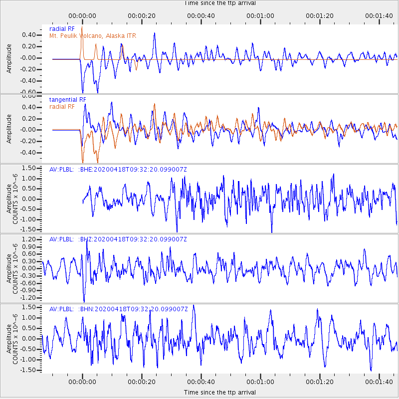
PLBL Mt. Peulik Volcano, Alaska - Earthquake Result Viewer
*The percent match for this event was below the threshold and hence no stack was calculated.
| Earthquake location: |
Bonin Islands, Japan Region |
| Earthquake latitude/longitude: |
27.2/140.1 |
| Earthquake time(UTC): |
2020/04/18 (109) 09:24:17 GMT |
| Earthquake Depth: |
468 km |
| Earthquake Magnitude: |
5.7 Mww |
| Earthquake Catalog/Contributor: |
NEIC PDE/us |
|
| Network: |
AV Alaska Volcano Observatory |
| Station: |
PLBL Mt. Peulik Volcano, Alaska |
| Lat/Lon: |
57.70 N/156.82 W |
| Elevation: |
461 m |
|
| Distance: |
53.2 deg |
| Az: |
36.758 deg |
| Baz: |
263.122 deg |
| Ray Param: |
$rayparam |
*The percent match for this event was below the threshold and hence was not used in the summary stack. |
|
| Radial Match: |
55.884346 % |
| Radial Bump: |
400 |
| Transverse Match: |
49.851776 % |
| Transverse Bump: |
400 |
| SOD ConfigId: |
21166931 |
| Insert Time: |
2020-05-02 09:29:23.167 +0000 |
| GWidth: |
2.5 |
| Max Bumps: |
400 |
| Tol: |
0.001 |
|
Signal To Noise
| Channel | StoN | STA | LTA |
| AV:PLBL: :BHZ:20200418T09:32:20.099007Z | 2.0669885 | 6.0195237E-7 | 2.9122197E-7 |
| AV:PLBL: :BHN:20200418T09:32:20.099007Z | 1.0916362 | 5.393349E-7 | 4.9406106E-7 |
| AV:PLBL: :BHE:20200418T09:32:20.099007Z | 1.8379662 | 6.7599325E-7 | 3.6779417E-7 |
| Arrivals |
| Ps | |
| PpPs | |
| PsPs/PpSs | |


