You are here: Home > Network List > CI - Caltech Regional Seismic Network Stations List
> Station TIN Tinemaha, Big Pine, CA, USA > Earthquake Result Viewer
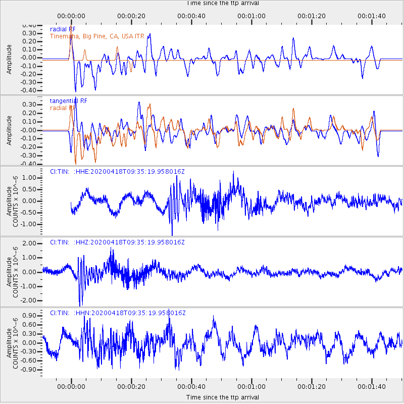
TIN Tinemaha, Big Pine, CA, USA - Earthquake Result Viewer
*The percent match for this event was below the threshold and hence no stack was calculated.
| Earthquake location: |
Bonin Islands, Japan Region |
| Earthquake latitude/longitude: |
27.2/140.1 |
| Earthquake time(UTC): |
2020/04/18 (109) 09:24:17 GMT |
| Earthquake Depth: |
468 km |
| Earthquake Magnitude: |
5.7 Mww |
| Earthquake Catalog/Contributor: |
NEIC PDE/us |
|
| Network: |
CI Caltech Regional Seismic Network |
| Station: |
TIN Tinemaha, Big Pine, CA, USA |
| Lat/Lon: |
37.05 N/118.23 W |
| Elevation: |
1197 m |
|
| Distance: |
82.6 deg |
| Az: |
52.175 deg |
| Baz: |
298.419 deg |
| Ray Param: |
$rayparam |
*The percent match for this event was below the threshold and hence was not used in the summary stack. |
|
| Radial Match: |
62.67796 % |
| Radial Bump: |
400 |
| Transverse Match: |
56.60028 % |
| Transverse Bump: |
400 |
| SOD ConfigId: |
21166931 |
| Insert Time: |
2020-05-02 09:32:21.724 +0000 |
| GWidth: |
2.5 |
| Max Bumps: |
400 |
| Tol: |
0.001 |
|
Signal To Noise
| Channel | StoN | STA | LTA |
| CI:TIN: :HHZ:20200418T09:35:19.958016Z | 3.6990147 | 8.473547E-7 | 2.290758E-7 |
| CI:TIN: :HHN:20200418T09:35:19.958016Z | 1.1283784 | 2.905769E-7 | 2.5751726E-7 |
| CI:TIN: :HHE:20200418T09:35:19.958016Z | 1.8475375 | 5.16643E-7 | 2.7963873E-7 |
| Arrivals |
| Ps | |
| PpPs | |
| PsPs/PpSs | |


