You are here: Home > Network List > CN - Canadian National Seismograph Network Stations List
> Station INK INUVIK, NT > Earthquake Result Viewer
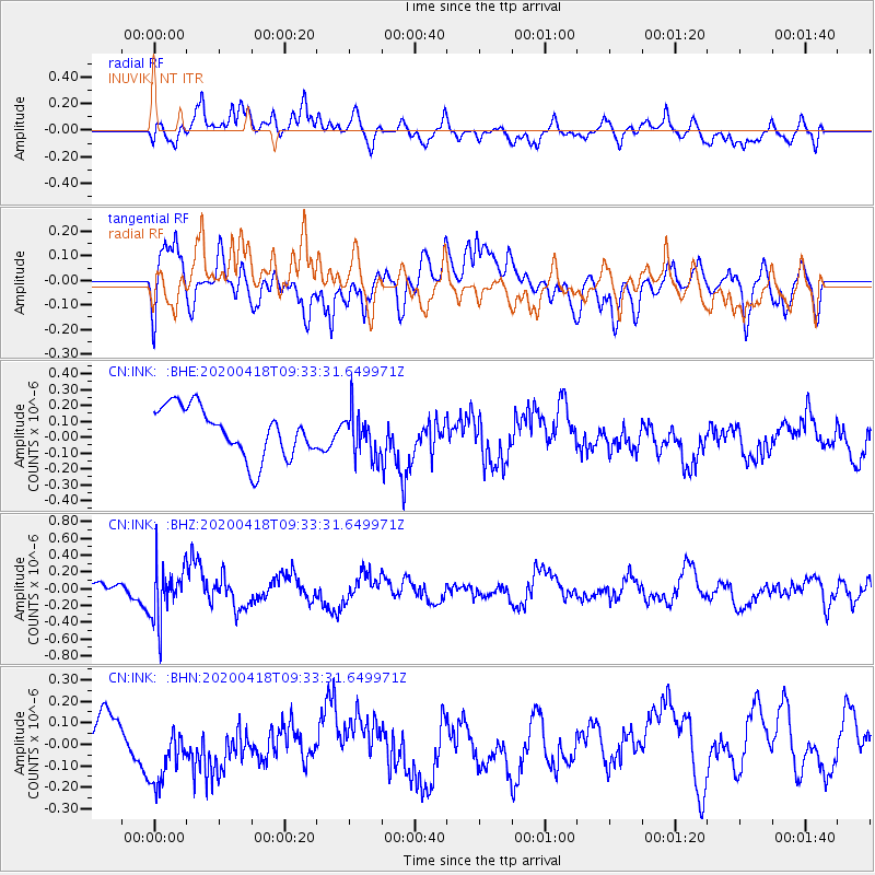
INK INUVIK, NT - Earthquake Result Viewer
*The percent match for this event was below the threshold and hence no stack was calculated.
| Earthquake location: |
Bonin Islands, Japan Region |
| Earthquake latitude/longitude: |
27.2/140.1 |
| Earthquake time(UTC): |
2020/04/18 (109) 09:24:17 GMT |
| Earthquake Depth: |
468 km |
| Earthquake Magnitude: |
5.7 Mww |
| Earthquake Catalog/Contributor: |
NEIC PDE/us |
|
| Network: |
CN Canadian National Seismograph Network |
| Station: |
INK INUVIK, NT |
| Lat/Lon: |
68.31 N/133.53 W |
| Elevation: |
44 m |
|
| Distance: |
63.7 deg |
| Az: |
24.444 deg |
| Baz: |
277.507 deg |
| Ray Param: |
$rayparam |
*The percent match for this event was below the threshold and hence was not used in the summary stack. |
|
| Radial Match: |
57.46487 % |
| Radial Bump: |
400 |
| Transverse Match: |
51.25651 % |
| Transverse Bump: |
400 |
| SOD ConfigId: |
21166931 |
| Insert Time: |
2020-05-02 09:32:54.616 +0000 |
| GWidth: |
2.5 |
| Max Bumps: |
400 |
| Tol: |
0.001 |
|
Signal To Noise
| Channel | StoN | STA | LTA |
| CN:INK: :BHZ:20200418T09:33:31.649971Z | 3.73225 | 3.2357858E-7 | 8.6697995E-8 |
| CN:INK: :BHN:20200418T09:33:31.649971Z | 1.3223106 | 1.8696663E-7 | 1.4139388E-7 |
| CN:INK: :BHE:20200418T09:33:31.649971Z | 0.9002608 | 1.3909676E-7 | 1.5450718E-7 |
| Arrivals |
| Ps | |
| PpPs | |
| PsPs/PpSs | |


