You are here: Home > Network List > IU - Global Seismograph Network (GSN - IRIS/USGS) Stations List
> Station JOHN Johnston Island, USA > Earthquake Result Viewer
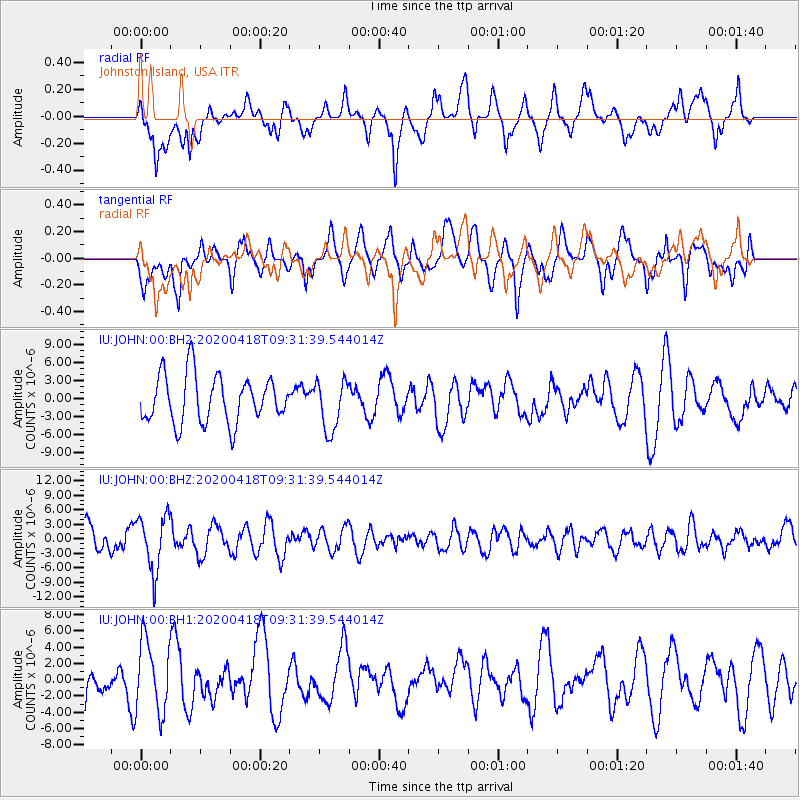
JOHN Johnston Island, USA - Earthquake Result Viewer
*The percent match for this event was below the threshold and hence no stack was calculated.
| Earthquake location: |
Bonin Islands, Japan Region |
| Earthquake latitude/longitude: |
27.2/140.1 |
| Earthquake time(UTC): |
2020/04/18 (109) 09:24:17 GMT |
| Earthquake Depth: |
468 km |
| Earthquake Magnitude: |
5.7 Mww |
| Earthquake Catalog/Contributor: |
NEIC PDE/us |
|
| Network: |
IU Global Seismograph Network (GSN - IRIS/USGS) |
| Station: |
JOHN Johnston Island, USA |
| Lat/Lon: |
16.73 N/169.53 W |
| Elevation: |
2.0 m |
|
| Distance: |
47.6 deg |
| Az: |
91.759 deg |
| Baz: |
291.69 deg |
| Ray Param: |
$rayparam |
*The percent match for this event was below the threshold and hence was not used in the summary stack. |
|
| Radial Match: |
55.680435 % |
| Radial Bump: |
400 |
| Transverse Match: |
52.29869 % |
| Transverse Bump: |
400 |
| SOD ConfigId: |
21166931 |
| Insert Time: |
2020-05-02 09:35:51.260 +0000 |
| GWidth: |
2.5 |
| Max Bumps: |
400 |
| Tol: |
0.001 |
|
Signal To Noise
| Channel | StoN | STA | LTA |
| IU:JOHN:00:BHZ:20200418T09:31:39.544014Z | 2.6085424 | 5.764865E-6 | 2.2099948E-6 |
| IU:JOHN:00:BH1:20200418T09:31:39.544014Z | 1.2368264 | 4.4101503E-6 | 3.5656985E-6 |
| IU:JOHN:00:BH2:20200418T09:31:39.544014Z | 1.0549678 | 4.143756E-6 | 3.927851E-6 |
| Arrivals |
| Ps | |
| PpPs | |
| PsPs/PpSs | |


