You are here: Home > Network List > TA - USArray Transportable Network (new EarthScope stations) Stations List
> Station D23K Nanushuk River, AK USA > Earthquake Result Viewer
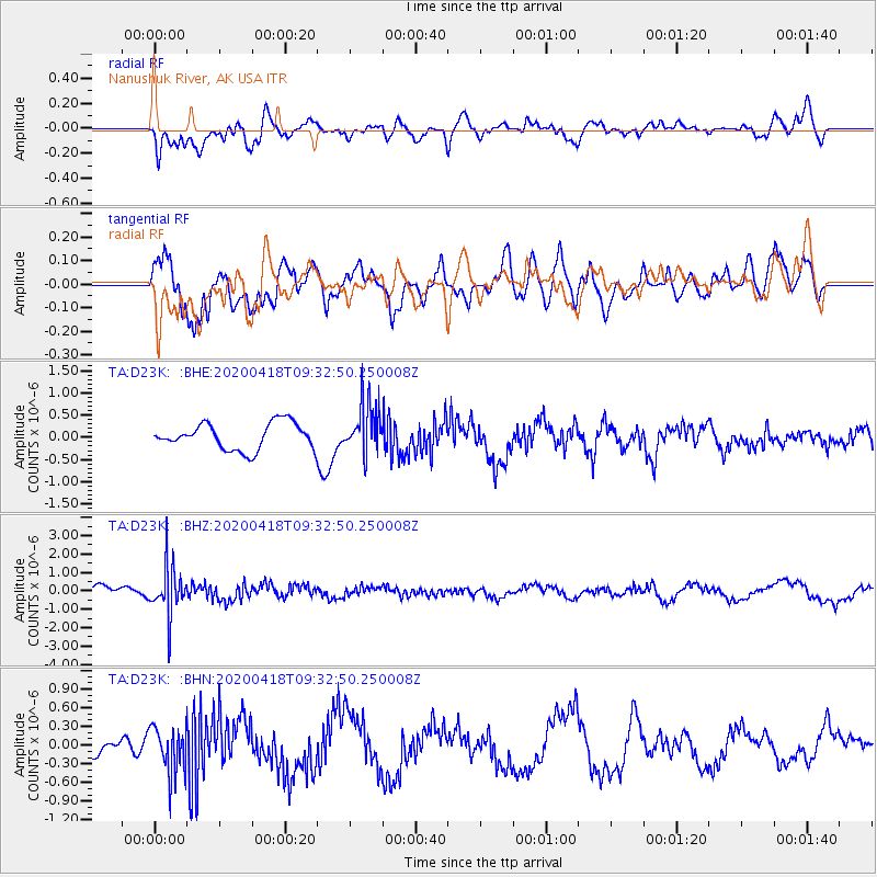
D23K Nanushuk River, AK USA - Earthquake Result Viewer
*The percent match for this event was below the threshold and hence no stack was calculated.
| Earthquake location: |
Bonin Islands, Japan Region |
| Earthquake latitude/longitude: |
27.2/140.1 |
| Earthquake time(UTC): |
2020/04/18 (109) 09:24:17 GMT |
| Earthquake Depth: |
468 km |
| Earthquake Magnitude: |
5.7 Mww |
| Earthquake Catalog/Contributor: |
NEIC PDE/us |
|
| Network: |
TA USArray Transportable Network (new EarthScope stations) |
| Station: |
D23K Nanushuk River, AK USA |
| Lat/Lon: |
68.97 N/150.68 W |
| Elevation: |
406 m |
|
| Distance: |
57.5 deg |
| Az: |
23.606 deg |
| Baz: |
261.117 deg |
| Ray Param: |
$rayparam |
*The percent match for this event was below the threshold and hence was not used in the summary stack. |
|
| Radial Match: |
56.633957 % |
| Radial Bump: |
400 |
| Transverse Match: |
48.575005 % |
| Transverse Bump: |
400 |
| SOD ConfigId: |
21166931 |
| Insert Time: |
2020-05-02 09:40:45.940 +0000 |
| GWidth: |
2.5 |
| Max Bumps: |
400 |
| Tol: |
0.001 |
|
Signal To Noise
| Channel | StoN | STA | LTA |
| TA:D23K: :BHZ:20200418T09:32:50.250008Z | 4.539761 | 1.3342238E-6 | 2.938974E-7 |
| TA:D23K: :BHN:20200418T09:32:50.250008Z | 3.2721682 | 3.7240295E-7 | 1.13809236E-7 |
| TA:D23K: :BHE:20200418T09:32:50.250008Z | 1.9086478 | 5.648033E-7 | 2.9591803E-7 |
| Arrivals |
| Ps | |
| PpPs | |
| PsPs/PpSs | |


