You are here: Home > Network List > TA - USArray Transportable Network (new EarthScope stations) Stations List
> Station F26K Sheenjek River, AK, USA > Earthquake Result Viewer
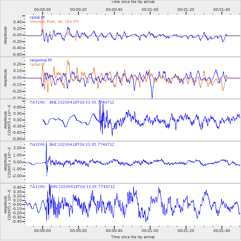
F26K Sheenjek River, AK, USA - Earthquake Result Viewer
*The percent match for this event was below the threshold and hence no stack was calculated.
| Earthquake location: |
Bonin Islands, Japan Region |
| Earthquake latitude/longitude: |
27.2/140.1 |
| Earthquake time(UTC): |
2020/04/18 (109) 09:24:17 GMT |
| Earthquake Depth: |
468 km |
| Earthquake Magnitude: |
5.7 Mww |
| Earthquake Catalog/Contributor: |
NEIC PDE/us |
|
| Network: |
TA USArray Transportable Network (new EarthScope stations) |
| Station: |
F26K Sheenjek River, AK, USA |
| Lat/Lon: |
67.69 N/144.15 W |
| Elevation: |
683 m |
|
| Distance: |
59.8 deg |
| Az: |
25.36 deg |
| Baz: |
268.1 deg |
| Ray Param: |
$rayparam |
*The percent match for this event was below the threshold and hence was not used in the summary stack. |
|
| Radial Match: |
46.55143 % |
| Radial Bump: |
400 |
| Transverse Match: |
60.018883 % |
| Transverse Bump: |
400 |
| SOD ConfigId: |
21166931 |
| Insert Time: |
2020-05-02 09:41:21.456 +0000 |
| GWidth: |
2.5 |
| Max Bumps: |
400 |
| Tol: |
0.001 |
|
Signal To Noise
| Channel | StoN | STA | LTA |
| TA:F26K: :BHZ:20200418T09:33:05.774971Z | 4.725905 | 7.193149E-7 | 1.5220682E-7 |
| TA:F26K: :BHN:20200418T09:33:05.774971Z | 1.5028926 | 1.7281508E-7 | 1.1498831E-7 |
| TA:F26K: :BHE:20200418T09:33:05.774971Z | 2.30173 | 3.0369915E-7 | 1.3194388E-7 |
| Arrivals |
| Ps | |
| PpPs | |
| PsPs/PpSs | |


