You are here: Home > Network List > TA - USArray Transportable Network (new EarthScope stations) Stations List
> Station H16K Elim, AK, USA > Earthquake Result Viewer
H16K Elim, AK, USA - Earthquake Result Viewer
*The percent match for this event was below the threshold and hence no stack was calculated.
| Earthquake location: |
Bonin Islands, Japan Region |
| Earthquake latitude/longitude: |
27.2/140.1 |
| Earthquake time(UTC): |
2020/04/18 (109) 09:24:17 GMT |
| Earthquake Depth: |
468 km |
| Earthquake Magnitude: |
5.7 Mww |
| Earthquake Catalog/Contributor: |
NEIC PDE/us |
|
| Network: |
TA USArray Transportable Network (new EarthScope stations) |
| Station: |
H16K Elim, AK, USA |
| Lat/Lon: |
64.64 N/162.24 W |
| Elevation: |
216 m |
|
| Distance: |
52.0 deg |
| Az: |
27.499 deg |
| Baz: |
252.741 deg |
| Ray Param: |
$rayparam |
*The percent match for this event was below the threshold and hence was not used in the summary stack. |
|
| Radial Match: |
52.533054 % |
| Radial Bump: |
400 |
| Transverse Match: |
63.182304 % |
| Transverse Bump: |
400 |
| SOD ConfigId: |
21166931 |
| Insert Time: |
2020-05-02 09:41:40.848 +0000 |
| GWidth: |
2.5 |
| Max Bumps: |
400 |
| Tol: |
0.001 |
|
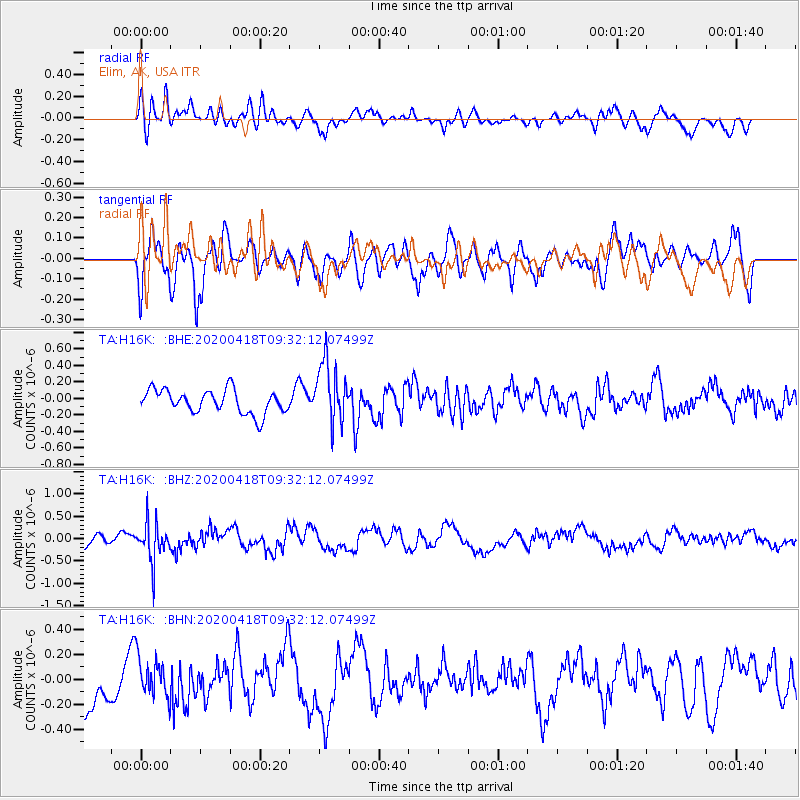
Signal To Noise
| Channel | StoN | STA | LTA |
| TA:H16K: :BHZ:20200418T09:32:12.07499Z | 1.9978819 | 4.422144E-7 | 2.2134161E-7 |
| TA:H16K: :BHN:20200418T09:32:12.07499Z | 0.7632769 | 1.6024624E-7 | 2.099451E-7 |
| TA:H16K: :BHE:20200418T09:32:12.07499Z | 2.5820615 | 3.6616893E-7 | 1.4181263E-7 |
| Arrivals |
| Ps | |
| PpPs | |
| PsPs/PpSs | |


