You are here: Home > Network List > US - United States National Seismic Network Stations List
> Station HAWA Hanford, Washington, USA > Earthquake Result Viewer
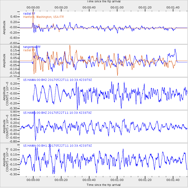
HAWA Hanford, Washington, USA - Earthquake Result Viewer
*The percent match for this event was below the threshold and hence no stack was calculated.
| Earthquake location: |
Kuril Islands |
| Earthquake latitude/longitude: |
43.9/147.7 |
| Earthquake time(UTC): |
2017/05/22 (142) 11:00:57 GMT |
| Earthquake Depth: |
54 km |
| Earthquake Magnitude: |
5.5 Mww |
| Earthquake Catalog/Contributor: |
NEIC PDE/us |
|
| Network: |
US United States National Seismic Network |
| Station: |
HAWA Hanford, Washington, USA |
| Lat/Lon: |
46.39 N/119.53 W |
| Elevation: |
364 m |
|
| Distance: |
61.6 deg |
| Az: |
51.778 deg |
| Baz: |
304.898 deg |
| Ray Param: |
$rayparam |
*The percent match for this event was below the threshold and hence was not used in the summary stack. |
|
| Radial Match: |
65.24385 % |
| Radial Bump: |
400 |
| Transverse Match: |
53.386517 % |
| Transverse Bump: |
400 |
| SOD ConfigId: |
2028011 |
| Insert Time: |
2017-06-05 11:09:00.763 +0000 |
| GWidth: |
2.5 |
| Max Bumps: |
400 |
| Tol: |
0.001 |
|
Signal To Noise
| Channel | StoN | STA | LTA |
| US:HAWA:00:BHZ:20170522T11:10:39.423979Z | 3.7241964 | 3.496961E-7 | 9.3898414E-8 |
| US:HAWA:00:BH1:20170522T11:10:39.423979Z | 1.7713782 | 1.5000437E-7 | 8.468229E-8 |
| US:HAWA:00:BH2:20170522T11:10:39.423979Z | 1.1248555 | 1.252047E-7 | 1.11307365E-7 |
| Arrivals |
| Ps | |
| PpPs | |
| PsPs/PpSs | |


