CHM KN.CHM - Earthquake Result Viewer
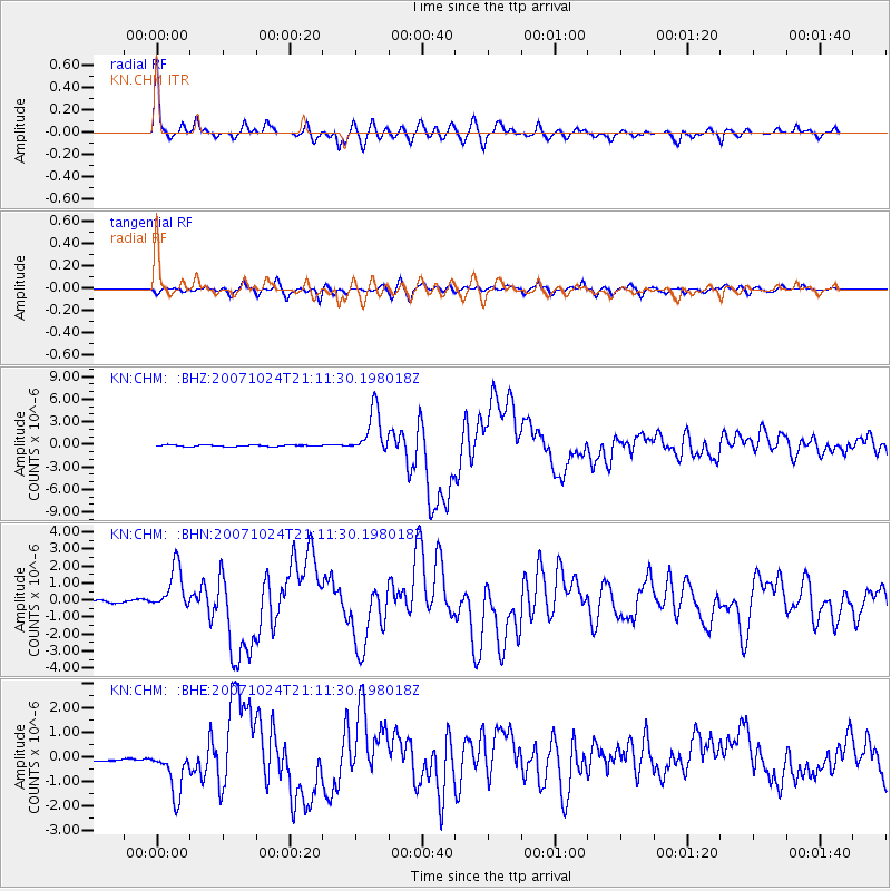
Earthquake location: Southern Sumatra, Indonesia
Earthquake latitude/longitude: -3.9/101.0
Earthquake time(UTC): 2007/10/24 (297) 21:02:50 GMT
Earthquake Depth: 20 km
Earthquake Magnitude: 6.1 MB, 6.9 MS, 6.8 MW, 6.3 ME
Earthquake Catalog/Contributor: WHDF/NEIC
Network: KN Kyrgyz Seismic Telemetry Network
Station: CHM KN.CHM
Lat/Lon: 43.00 N/74.75 E
Elevation: 655 m
Distance: 52.4 deg
Az: 335.799 deg
Baz: 146.118 deg
Ray Param: 0.06677769
Estimated Moho Depth: 57.75 km
Estimated Crust Vp/Vs: 1.61
Assumed Crust Vp: 6.306 km/s
Estimated Crust Vs: 3.911 km/s
Estimated Crust Poisson's Ratio: 0.19
Radial Match: 96.02132 %
Radial Bump: 380
Transverse Match: 86.54836 %
Transverse Bump: 400
SOD ConfigId: 2564
Insert Time: 2010-03-08 19:31:04.132 +0000
GWidth: 2.5
Max Bumps: 400
Tol: 0.001

Signal To Noise

ChannelStoNSTALTA
KN:CHM: :BHN:20071024T21:11:30.198018Z19.326211.3183203E-66.821411E-8
KN:CHM: :BHE:20071024T21:11:30.198018Z7.08201369.76473E-71.378807E-7
KN:CHM: :BHZ:20071024T21:11:30.198018Z30.0818982.9656333E-69.858532E-8
Arrivals
Ps5.9 SECOND
PpPs23 SECOND
PsPs/PpSs29 SECOND