CHM KN.CHM - Earthquake Result Viewer
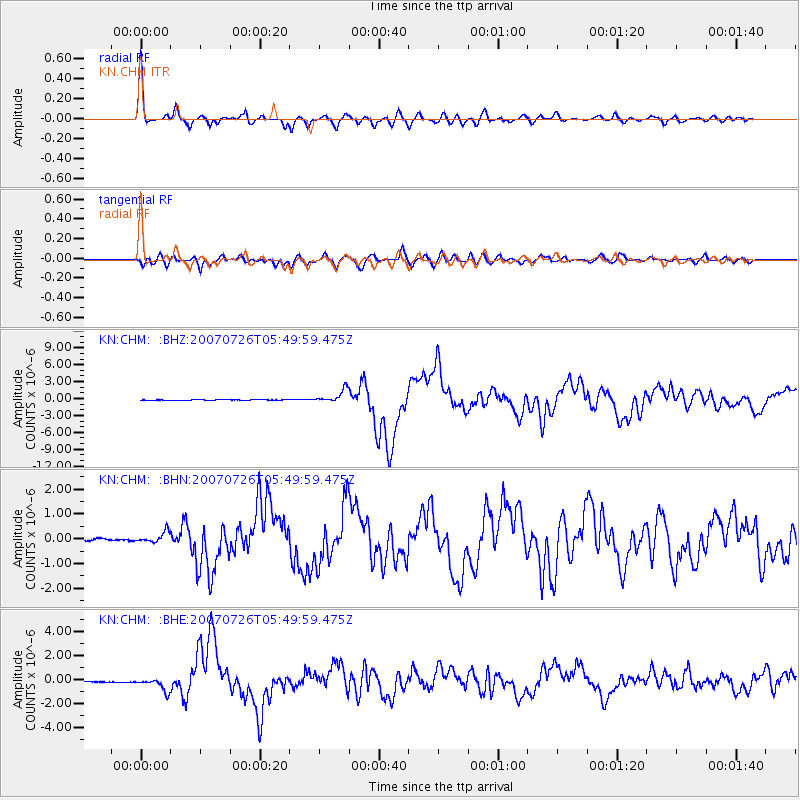
Earthquake location: Northern Molucca Sea
Earthquake latitude/longitude: 2.9/127.5
Earthquake time(UTC): 2007/07/26 (207) 05:40:16 GMT
Earthquake Depth: 25 km
Earthquake Magnitude: 6.4 MB, 6.8 MS, 6.9 MW, 6.9 MW
Earthquake Catalog/Contributor: WHDF/NEIC
Network: KN Kyrgyz Seismic Telemetry Network
Station: CHM KN.CHM
Lat/Lon: 43.00 N/74.75 E
Elevation: 655 m
Distance: 61.5 deg
Az: 318.362 deg
Baz: 115.243 deg
Ray Param: 0.06082321
Estimated Moho Depth: 47.5 km
Estimated Crust Vp/Vs: 1.73
Assumed Crust Vp: 6.306 km/s
Estimated Crust Vs: 3.64 km/s
Estimated Crust Poisson's Ratio: 0.25
Radial Match: 97.00403 %
Radial Bump: 400
Transverse Match: 94.67818 %
Transverse Bump: 400
SOD ConfigId: 2564
Insert Time: 2010-03-08 19:31:24.792 +0000
GWidth: 2.5
Max Bumps: 400
Tol: 0.001

Signal To Noise

ChannelStoNSTALTA
KN:CHM: :BHN:20070726T05:49:59.475Z4.238992.0462949E-74.8273172E-8
KN:CHM: :BHE:20070726T05:49:59.475Z13.7884455.255463E-73.8114976E-8
KN:CHM: :BHZ:20070726T05:49:59.475Z23.267521.1420753E-64.9084527E-8
Arrivals
Ps5.8 SECOND
PpPs20 SECOND
PsPs/PpSs25 SECOND