You are here: Home > Network List > TS - TERRAscope (Southern California Seismic Network) Stations List
> Station SBC Santa Barbara, California, USA > Earthquake Result Viewer
SBC Santa Barbara, California, USA - Earthquake Result Viewer
*The percent match for this event was below the threshold and hence no stack was calculated.
| Earthquake location: |
Tonga Islands |
| Earthquake latitude/longitude: |
-18.0/-173.7 |
| Earthquake time(UTC): |
1991/01/08 (008) 22:04:10 GMT |
| Earthquake Depth: |
43 km |
| Earthquake Magnitude: |
6.1 MB, 6.0 MS, 6.3 UNKNOWN |
| Earthquake Catalog/Contributor: |
WHDF/NEIC |
|
| Network: |
TS TERRAscope (Southern California Seismic Network) |
| Station: |
SBC Santa Barbara, California, USA |
| Lat/Lon: |
34.44 N/119.71 W |
| Elevation: |
90 m |
|
| Distance: |
73.2 deg |
| Az: |
44.277 deg |
| Baz: |
233.496 deg |
| Ray Param: |
$rayparam |
*The percent match for this event was below the threshold and hence was not used in the summary stack. |
|
| Radial Match: |
59.759422 % |
| Radial Bump: |
400 |
| Transverse Match: |
59.210495 % |
| Transverse Bump: |
400 |
| SOD ConfigId: |
4480 |
| Insert Time: |
2010-02-26 14:48:15.408 +0000 |
| GWidth: |
2.5 |
| Max Bumps: |
400 |
| Tol: |
0.001 |
|
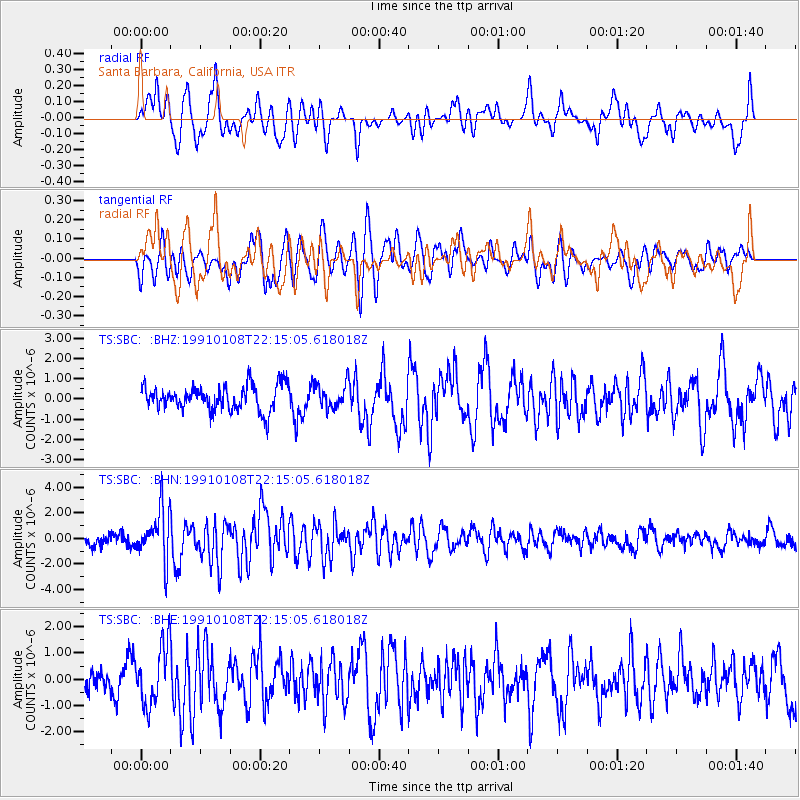
Signal To Noise
| Channel | StoN | STA | LTA |
| TS:SBC: :BHN:19910108T22:15:05.618018Z | 4.6253543 | 1.9650122E-6 | 4.2483495E-7 |
| TS:SBC: :BHE:19910108T22:15:05.618018Z | 1.8246199 | 1.126766E-6 | 6.175347E-7 |
| TS:SBC: :BHZ:19910108T22:15:05.618018Z | 0.9704801 | 5.993723E-7 | 6.176039E-7 |
| Arrivals |
| Ps | |
| PpPs | |
| PsPs/PpSs | |


