You are here: Home > Network List > CI - Caltech Regional Seismic Network Stations List
> Station MPM Manuel Prospect Mine, California, USA > Earthquake Result Viewer
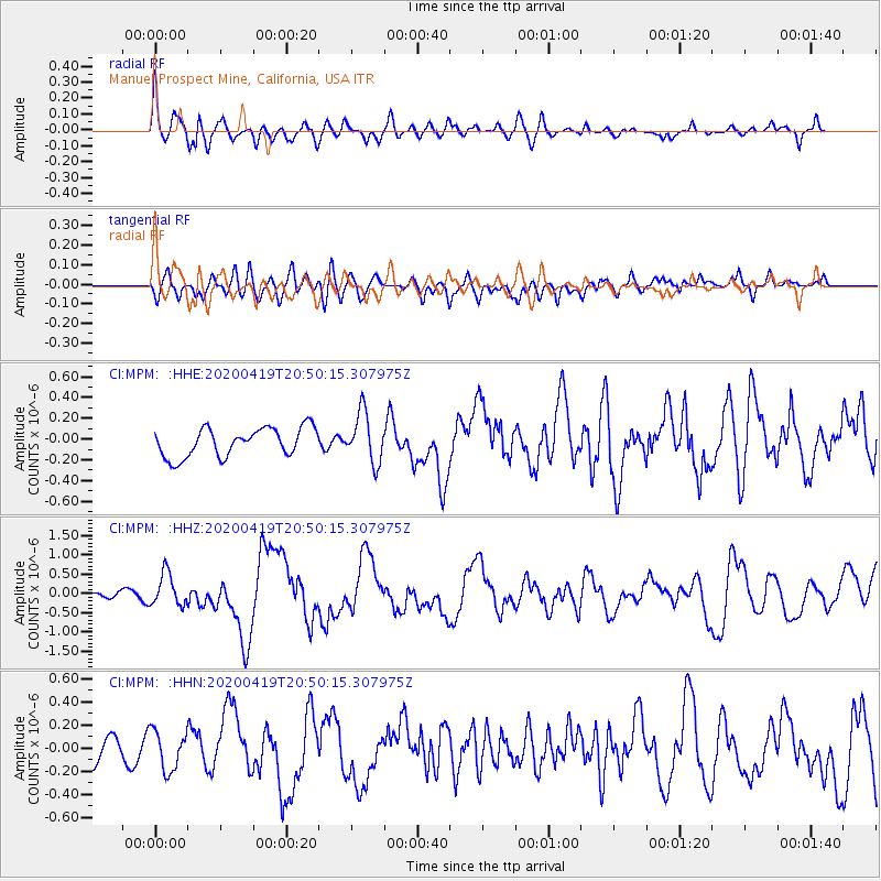
MPM Manuel Prospect Mine, California, USA - Earthquake Result Viewer
*The percent match for this event was below the threshold and hence no stack was calculated.
| Earthquake location: |
Near East Coast Of Honshu, Japan |
| Earthquake latitude/longitude: |
38.9/141.9 |
| Earthquake time(UTC): |
2020/04/19 (110) 20:39:05 GMT |
| Earthquake Depth: |
38 km |
| Earthquake Magnitude: |
6.3 mww |
| Earthquake Catalog/Contributor: |
NEIC PDE/us |
|
| Network: |
CI Caltech Regional Seismic Network |
| Station: |
MPM Manuel Prospect Mine, California, USA |
| Lat/Lon: |
36.06 N/117.49 W |
| Elevation: |
185 m |
|
| Distance: |
75.5 deg |
| Az: |
55.362 deg |
| Baz: |
307.611 deg |
| Ray Param: |
$rayparam |
*The percent match for this event was below the threshold and hence was not used in the summary stack. |
|
| Radial Match: |
74.26326 % |
| Radial Bump: |
400 |
| Transverse Match: |
58.504795 % |
| Transverse Bump: |
400 |
| SOD ConfigId: |
21166931 |
| Insert Time: |
2020-05-03 20:47:28.071 +0000 |
| GWidth: |
2.5 |
| Max Bumps: |
400 |
| Tol: |
0.001 |
|
Signal To Noise
| Channel | StoN | STA | LTA |
| CI:MPM: :HHZ:20200419T20:50:15.307975Z | 3.2539794 | 4.1713434E-7 | 1.2819207E-7 |
| CI:MPM: :HHN:20200419T20:50:15.307975Z | 1.2108567 | 1.702676E-7 | 1.4061746E-7 |
| CI:MPM: :HHE:20200419T20:50:15.307975Z | 1.7479696 | 2.4036194E-7 | 1.3750922E-7 |
| Arrivals |
| Ps | |
| PpPs | |
| PsPs/PpSs | |


