You are here: Home > Network List > TS - TERRAscope (Southern California Seismic Network) Stations List
> Station SBC Santa Barbara, California, USA > Earthquake Result Viewer
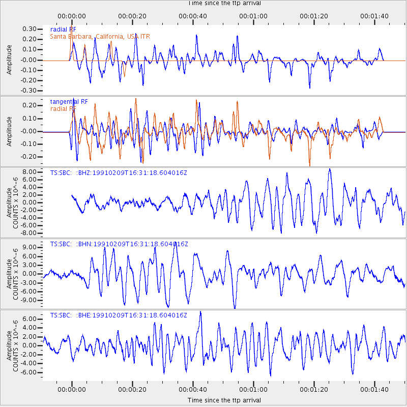
SBC Santa Barbara, California, USA - Earthquake Result Viewer
*The percent match for this event was below the threshold and hence no stack was calculated.
| Earthquake location: |
Solomon Islands |
| Earthquake latitude/longitude: |
-9.9/159.1 |
| Earthquake time(UTC): |
1991/02/09 (040) 16:18:58 GMT |
| Earthquake Depth: |
10 km |
| Earthquake Magnitude: |
6.3 MB, 6.9 MS, 6.8 UNKNOWN |
| Earthquake Catalog/Contributor: |
WHDF/NEIC |
|
| Network: |
TS TERRAscope (Southern California Seismic Network) |
| Station: |
SBC Santa Barbara, California, USA |
| Lat/Lon: |
34.44 N/119.71 W |
| Elevation: |
90 m |
|
| Distance: |
88.3 deg |
| Az: |
54.793 deg |
| Baz: |
256.962 deg |
| Ray Param: |
$rayparam |
*The percent match for this event was below the threshold and hence was not used in the summary stack. |
|
| Radial Match: |
88.980385 % |
| Radial Bump: |
400 |
| Transverse Match: |
81.52827 % |
| Transverse Bump: |
400 |
| SOD ConfigId: |
4480 |
| Insert Time: |
2010-02-26 14:48:17.934 +0000 |
| GWidth: |
2.5 |
| Max Bumps: |
400 |
| Tol: |
0.001 |
|
Signal To Noise
| Channel | StoN | STA | LTA |
| TS:SBC: :BHN:19910209T16:31:18.604016Z | 2.0332708 | 1.3258181E-6 | 6.520617E-7 |
| TS:SBC: :BHE:19910209T16:31:18.604016Z | 1.8336363 | 1.6718263E-6 | 9.117547E-7 |
| TS:SBC: :BHZ:19910209T16:31:18.604016Z | 1.0531999 | 1.1645403E-6 | 1.1057164E-6 |
| Arrivals |
| Ps | |
| PpPs | |
| PsPs/PpSs | |


