CHM KN.CHM - Earthquake Result Viewer
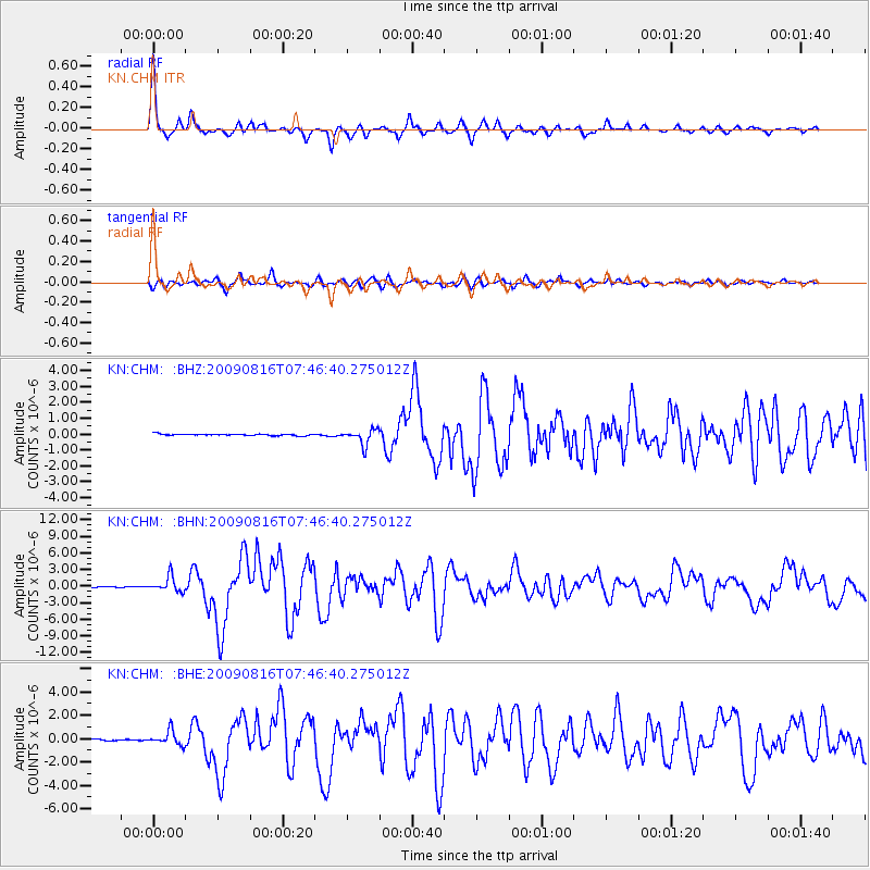
Earthquake location: Southern Sumatra, Indonesia
Earthquake latitude/longitude: -1.5/99.5
Earthquake time(UTC): 2009/08/16 (228) 07:38:21 GMT
Earthquake Depth: 20 km
Earthquake Magnitude: 6.5 MB, 6.7 MS, 6.7 MW, 6.5 MW
Earthquake Catalog/Contributor: WHDF/NEIC
Network: KN Kyrgyz Seismic Telemetry Network
Station: CHM KN.CHM
Lat/Lon: 43.00 N/74.75 E
Elevation: 655 m
Distance: 49.6 deg
Az: 336.209 deg
Baz: 146.655 deg
Ray Param: 0.068599254
Estimated Moho Depth: 56.25 km
Estimated Crust Vp/Vs: 1.62
Assumed Crust Vp: 6.306 km/s
Estimated Crust Vs: 3.899 km/s
Estimated Crust Poisson's Ratio: 0.19
Radial Match: 95.18904 %
Radial Bump: 306
Transverse Match: 88.46961 %
Transverse Bump: 400
SOD ConfigId: 2622
Insert Time: 2010-03-08 19:32:18.359 +0000
GWidth: 2.5
Max Bumps: 400
Tol: 0.001

Signal To Noise

ChannelStoNSTALTA
KN:CHM: :BHN:20090816T07:46:40.275012Z24.4761031.3549059E-65.535627E-8
KN:CHM: :BHE:20090816T07:46:40.275012Z9.4509356.1025355E-76.4570706E-8
KN:CHM: :BHZ:20090816T07:46:40.275012Z9.7467174.851014E-74.9770748E-8
Arrivals
Ps5.9 SECOND
PpPs22 SECOND
PsPs/PpSs28 SECOND