You are here: Home > Network List > IW - Intermountain West Stations List
> Station MOOW Moose Ponds, Wyoming, USA > Earthquake Result Viewer
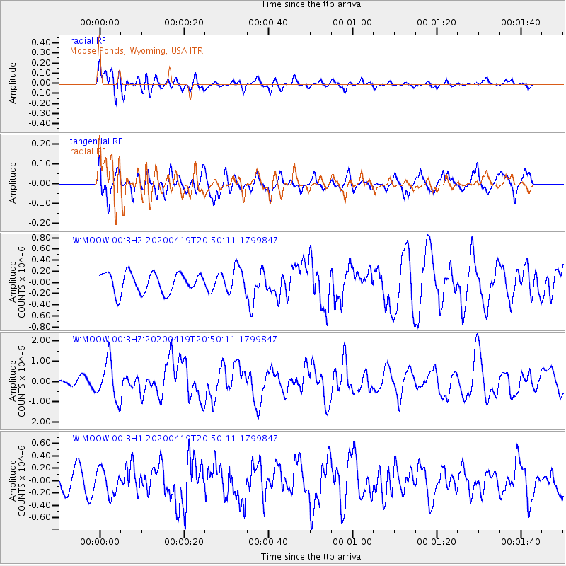
MOOW Moose Ponds, Wyoming, USA - Earthquake Result Viewer
*The percent match for this event was below the threshold and hence no stack was calculated.
| Earthquake location: |
Near East Coast Of Honshu, Japan |
| Earthquake latitude/longitude: |
38.9/141.9 |
| Earthquake time(UTC): |
2020/04/19 (110) 20:39:05 GMT |
| Earthquake Depth: |
38 km |
| Earthquake Magnitude: |
6.3 mww |
| Earthquake Catalog/Contributor: |
NEIC PDE/us |
|
| Network: |
IW Intermountain West |
| Station: |
MOOW Moose Ponds, Wyoming, USA |
| Lat/Lon: |
43.75 N/110.74 W |
| Elevation: |
2128 m |
|
| Distance: |
74.8 deg |
| Az: |
45.808 deg |
| Baz: |
309.476 deg |
| Ray Param: |
$rayparam |
*The percent match for this event was below the threshold and hence was not used in the summary stack. |
|
| Radial Match: |
77.08657 % |
| Radial Bump: |
400 |
| Transverse Match: |
59.292885 % |
| Transverse Bump: |
400 |
| SOD ConfigId: |
21166931 |
| Insert Time: |
2020-05-03 20:53:55.060 +0000 |
| GWidth: |
2.5 |
| Max Bumps: |
400 |
| Tol: |
0.001 |
|
Signal To Noise
| Channel | StoN | STA | LTA |
| IW:MOOW:00:BHZ:20200419T20:50:11.179984Z | 3.1454008 | 9.87411E-7 | 3.1392216E-7 |
| IW:MOOW:00:BH1:20200419T20:50:11.179984Z | 1.1481109 | 2.0734129E-7 | 1.8059343E-7 |
| IW:MOOW:00:BH2:20200419T20:50:11.179984Z | 1.2585245 | 2.2094986E-7 | 1.755626E-7 |
| Arrivals |
| Ps | |
| PpPs | |
| PsPs/PpSs | |


