You are here: Home > Network List > KN - Kyrgyz Seismic Telemetry Network Stations List
> Station CHM KN.CHM > Earthquake Result Viewer
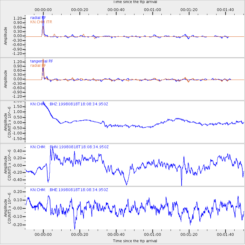
CHM KN.CHM - Earthquake Result Viewer
*The percent match for this event was below the threshold and hence no stack was calculated.
| Earthquake location: |
Kuril Islands |
| Earthquake latitude/longitude: |
45.9/149.1 |
| Earthquake time(UTC): |
1998/08/18 (230) 18:00:12 GMT |
| Earthquake Depth: |
116 km |
| Earthquake Magnitude: |
5.6 UNKNOWN, 5.4 MB, 5.6 MW |
| Earthquake Catalog/Contributor: |
WHDF/NEIC |
|
| Network: |
KN Kyrgyz Seismic Telemetry Network |
| Station: |
CHM KN.CHM |
| Lat/Lon: |
43.00 N/74.75 E |
| Elevation: |
655 m |
|
| Distance: |
51.4 deg |
| Az: |
295.271 deg |
| Baz: |
59.484 deg |
| Ray Param: |
$rayparam |
*The percent match for this event was below the threshold and hence was not used in the summary stack. |
|
| Radial Match: |
95.32664 % |
| Radial Bump: |
221 |
| Transverse Match: |
93.882545 % |
| Transverse Bump: |
269 |
| SOD ConfigId: |
4480 |
| Insert Time: |
2010-03-08 19:33:11.420 +0000 |
| GWidth: |
2.5 |
| Max Bumps: |
400 |
| Tol: |
0.001 |
|
Signal To Noise
| Channel | StoN | STA | LTA |
| KN:CHM: :BHN:19980818T18:08:34.950Z | 1.0302641 | 3.4653024E-7 | 3.363509E-7 |
| KN:CHM: :BHE:19980818T18:08:34.950Z | 0.98366815 | 9.2190305E-8 | 9.372094E-8 |
| KN:CHM: :BHZ:19980818T18:08:34.950Z | 0.89737815 | 4.4150036E-7 | 4.919892E-7 |
| Arrivals |
| Ps | |
| PpPs | |
| PsPs/PpSs | |


