You are here: Home > Network List > TA - USArray Transportable Network (new EarthScope stations) Stations List
> Station G31M Satah River, YT, CAN > Earthquake Result Viewer
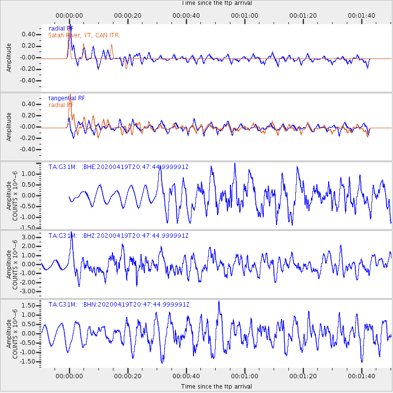
G31M Satah River, YT, CAN - Earthquake Result Viewer
*The percent match for this event was below the threshold and hence no stack was calculated.
| Earthquake location: |
Near East Coast Of Honshu, Japan |
| Earthquake latitude/longitude: |
38.9/141.9 |
| Earthquake time(UTC): |
2020/04/19 (110) 20:39:05 GMT |
| Earthquake Depth: |
38 km |
| Earthquake Magnitude: |
6.3 mww |
| Earthquake Catalog/Contributor: |
NEIC PDE/us |
|
| Network: |
TA USArray Transportable Network (new EarthScope stations) |
| Station: |
G31M Satah River, YT, CAN |
| Lat/Lon: |
66.92 N/134.27 W |
| Elevation: |
61 m |
|
| Distance: |
52.5 deg |
| Az: |
29.583 deg |
| Baz: |
282.302 deg |
| Ray Param: |
$rayparam |
*The percent match for this event was below the threshold and hence was not used in the summary stack. |
|
| Radial Match: |
71.30721 % |
| Radial Bump: |
387 |
| Transverse Match: |
66.19932 % |
| Transverse Bump: |
400 |
| SOD ConfigId: |
21166931 |
| Insert Time: |
2020-05-03 21:03:24.900 +0000 |
| GWidth: |
2.5 |
| Max Bumps: |
400 |
| Tol: |
0.001 |
|
Signal To Noise
| Channel | StoN | STA | LTA |
| TA:G31M: :BHZ:20200419T20:47:44.999991Z | 5.5350833 | 1.5141924E-6 | 2.735627E-7 |
| TA:G31M: :BHN:20200419T20:47:44.999991Z | 1.1937184 | 5.86879E-7 | 4.916394E-7 |
| TA:G31M: :BHE:20200419T20:47:44.999991Z | 2.5680432 | 7.198578E-7 | 2.8031374E-7 |
| Arrivals |
| Ps | |
| PpPs | |
| PsPs/PpSs | |


