You are here: Home > Network List > TS - TERRAscope (Southern California Seismic Network) Stations List
> Station SBC Santa Barbara, California, USA > Earthquake Result Viewer
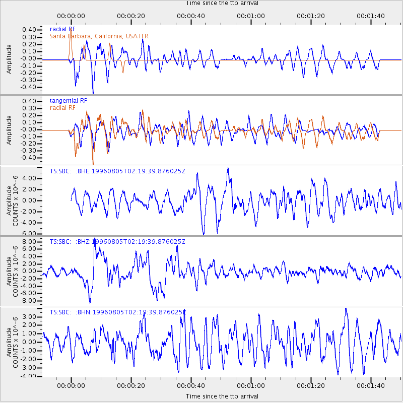
SBC Santa Barbara, California, USA - Earthquake Result Viewer
*The percent match for this event was below the threshold and hence no stack was calculated.
| Earthquake location: |
Tonga Islands |
| Earthquake latitude/longitude: |
-15.3/-173.1 |
| Earthquake time(UTC): |
1996/08/05 (218) 02:08:58 GMT |
| Earthquake Depth: |
41 km |
| Earthquake Magnitude: |
6.0 MB, 6.7 MS, 6.7 UNKNOWN, 6.2 ME |
| Earthquake Catalog/Contributor: |
WHDF/NEIC |
|
| Network: |
TS TERRAscope (Southern California Seismic Network) |
| Station: |
SBC Santa Barbara, California, USA |
| Lat/Lon: |
34.44 N/119.71 W |
| Elevation: |
90 m |
|
| Distance: |
70.8 deg |
| Az: |
44.629 deg |
| Baz: |
235.124 deg |
| Ray Param: |
$rayparam |
*The percent match for this event was below the threshold and hence was not used in the summary stack. |
|
| Radial Match: |
73.8504 % |
| Radial Bump: |
400 |
| Transverse Match: |
77.257675 % |
| Transverse Bump: |
400 |
| SOD ConfigId: |
4480 |
| Insert Time: |
2010-02-26 14:48:27.078 +0000 |
| GWidth: |
2.5 |
| Max Bumps: |
400 |
| Tol: |
0.001 |
|
Signal To Noise
| Channel | StoN | STA | LTA |
| TS:SBC: :BHZ:19960805T02:19:39.876025Z | 2.6078951 | 1.6215113E-6 | 6.2177014E-7 |
| TS:SBC: :BHN:19960805T02:19:39.876025Z | 1.3436524 | 1.1535901E-6 | 8.5854805E-7 |
| TS:SBC: :BHE:19960805T02:19:39.876025Z | 1.0764829 | 1.4187882E-6 | 1.3179849E-6 |
| Arrivals |
| Ps | |
| PpPs | |
| PsPs/PpSs | |


