You are here: Home > Network List > KN - Kyrgyz Seismic Telemetry Network Stations List
> Station CHM KN.CHM > Earthquake Result Viewer
CHM KN.CHM - Earthquake Result Viewer
*The percent match for this event was below the threshold and hence no stack was calculated.
| Earthquake location: |
Bali Sea |
| Earthquake latitude/longitude: |
-7.8/117.4 |
| Earthquake time(UTC): |
1997/02/15 (046) 12:11:14 GMT |
| Earthquake Depth: |
274 km |
| Earthquake Magnitude: |
5.6 MB, 5.6 UNKNOWN, 5.6 MW |
| Earthquake Catalog/Contributor: |
WHDF/NEIC |
|
| Network: |
KN Kyrgyz Seismic Telemetry Network |
| Station: |
CHM KN.CHM |
| Lat/Lon: |
43.00 N/74.75 E |
| Elevation: |
655 m |
|
| Distance: |
63.7 deg |
| Az: |
326.316 deg |
| Baz: |
131.488 deg |
| Ray Param: |
$rayparam |
*The percent match for this event was below the threshold and hence was not used in the summary stack. |
|
| Radial Match: |
70.85779 % |
| Radial Bump: |
400 |
| Transverse Match: |
48.63567 % |
| Transverse Bump: |
400 |
| SOD ConfigId: |
4480 |
| Insert Time: |
2010-03-08 19:33:47.667 +0000 |
| GWidth: |
2.5 |
| Max Bumps: |
400 |
| Tol: |
0.001 |
|
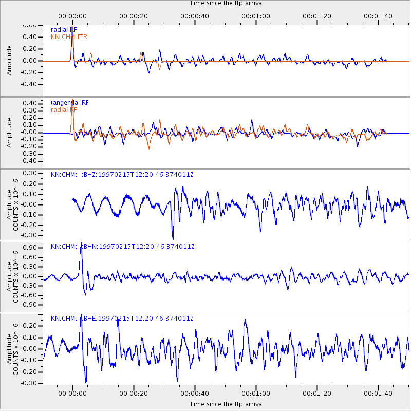
Signal To Noise
| Channel | StoN | STA | LTA |
| KN:CHM: :BHN:19970215T12:20:46.374011Z | 6.8251457 | 3.981883E-7 | 5.8341357E-8 |
| KN:CHM: :BHE:19970215T12:20:46.374011Z | 2.224393 | 1.3878416E-7 | 6.2391926E-8 |
| KN:CHM: :BHZ:19970215T12:20:46.374011Z | 1.9829789 | 1.2232228E-7 | 6.168612E-8 |
| Arrivals |
| Ps | |
| PpPs | |
| PsPs/PpSs | |


