You are here: Home > Network List > KN - Kyrgyz Seismic Telemetry Network Stations List
> Station CHM KN.CHM > Earthquake Result Viewer
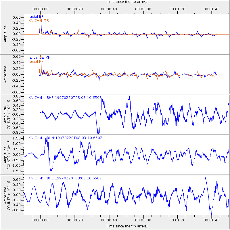
CHM KN.CHM - Earthquake Result Viewer
*The percent match for this event was below the threshold and hence no stack was calculated.
| Earthquake location: |
Hokkaido, Japan Region |
| Earthquake latitude/longitude: |
41.9/142.7 |
| Earthquake time(UTC): |
1997/02/20 (051) 07:54:58 GMT |
| Earthquake Depth: |
33 km |
| Earthquake Magnitude: |
5.4 MB, 5.5 MS, 6.0 UNKNOWN, 6.0 MW |
| Earthquake Catalog/Contributor: |
WHDF/NEIC |
|
| Network: |
KN Kyrgyz Seismic Telemetry Network |
| Station: |
CHM KN.CHM |
| Lat/Lon: |
43.00 N/74.75 E |
| Elevation: |
655 m |
|
| Distance: |
48.9 deg |
| Az: |
295.527 deg |
| Baz: |
66.753 deg |
| Ray Param: |
$rayparam |
*The percent match for this event was below the threshold and hence was not used in the summary stack. |
|
| Radial Match: |
76.86953 % |
| Radial Bump: |
330 |
| Transverse Match: |
55.554565 % |
| Transverse Bump: |
395 |
| SOD ConfigId: |
4480 |
| Insert Time: |
2010-03-08 19:33:49.705 +0000 |
| GWidth: |
2.5 |
| Max Bumps: |
400 |
| Tol: |
0.001 |
|
Signal To Noise
| Channel | StoN | STA | LTA |
| KN:CHM: :BHN:19970220T08:03:10.650Z | 7.221441 | 7.629282E-7 | 1.05647636E-7 |
| KN:CHM: :BHE:19970220T08:03:10.650Z | 1.6031921 | 2.3781222E-7 | 1.483367E-7 |
| KN:CHM: :BHZ:19970220T08:03:10.650Z | 3.9279878 | 4.0253764E-7 | 1.0247935E-7 |
| Arrivals |
| Ps | |
| PpPs | |
| PsPs/PpSs | |


