You are here: Home > Network List > WY - Yellowstone Wyoming Seismic Network Stations List
> Station YHH Holmes Hill, YNP, WY, USA > Earthquake Result Viewer
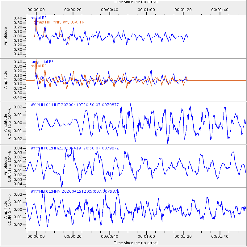
YHH Holmes Hill, YNP, WY, USA - Earthquake Result Viewer
*The percent match for this event was below the threshold and hence no stack was calculated.
| Earthquake location: |
Near East Coast Of Honshu, Japan |
| Earthquake latitude/longitude: |
38.9/141.9 |
| Earthquake time(UTC): |
2020/04/19 (110) 20:39:05 GMT |
| Earthquake Depth: |
38 km |
| Earthquake Magnitude: |
6.3 mww |
| Earthquake Catalog/Contributor: |
NEIC PDE/us |
|
| Network: |
WY Yellowstone Wyoming Seismic Network |
| Station: |
YHH Holmes Hill, YNP, WY, USA |
| Lat/Lon: |
44.79 N/110.85 W |
| Elevation: |
2717 m |
|
| Distance: |
74.1 deg |
| Az: |
45.023 deg |
| Baz: |
309.191 deg |
| Ray Param: |
$rayparam |
*The percent match for this event was below the threshold and hence was not used in the summary stack. |
|
| Radial Match: |
68.87731 % |
| Radial Bump: |
400 |
| Transverse Match: |
58.41178 % |
| Transverse Bump: |
400 |
| SOD ConfigId: |
21166931 |
| Insert Time: |
2020-05-03 21:09:57.270 +0000 |
| GWidth: |
2.5 |
| Max Bumps: |
400 |
| Tol: |
0.001 |
|
Signal To Noise
| Channel | StoN | STA | LTA |
| WY:YHH:01:HHZ:20200419T20:50:07.007987Z | 4.1328583 | 2.0423183E-8 | 4.9416604E-9 |
| WY:YHH:01:HHN:20200419T20:50:07.007987Z | 2.9305418 | 1.4069503E-8 | 4.8009903E-9 |
| WY:YHH:01:HHE:20200419T20:50:07.007987Z | 1.9608645 | 1.0061997E-8 | 5.1314086E-9 |
| Arrivals |
| Ps | |
| PpPs | |
| PsPs/PpSs | |


