You are here: Home > Network List > CI - Caltech Regional Seismic Network Stations List
> Station MPP McPhearson Peak > Earthquake Result Viewer
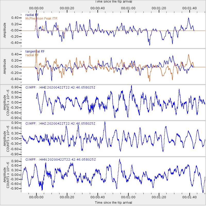
MPP McPhearson Peak - Earthquake Result Viewer
*The percent match for this event was below the threshold and hence no stack was calculated.
| Earthquake location: |
Tonga Islands Region |
| Earthquake latitude/longitude: |
-22.1/-175.5 |
| Earthquake time(UTC): |
2020/04/22 (113) 22:31:25 GMT |
| Earthquake Depth: |
40 km |
| Earthquake Magnitude: |
5.5 Mww |
| Earthquake Catalog/Contributor: |
NEIC PDE/us |
|
| Network: |
CI Caltech Regional Seismic Network |
| Station: |
MPP McPhearson Peak |
| Lat/Lon: |
34.89 N/119.81 W |
| Elevation: |
1739 m |
|
| Distance: |
77.5 deg |
| Az: |
44.07 deg |
| Baz: |
231.698 deg |
| Ray Param: |
$rayparam |
*The percent match for this event was below the threshold and hence was not used in the summary stack. |
|
| Radial Match: |
56.904526 % |
| Radial Bump: |
400 |
| Transverse Match: |
39.21681 % |
| Transverse Bump: |
400 |
| SOD ConfigId: |
21166931 |
| Insert Time: |
2020-05-06 22:37:14.965 +0000 |
| GWidth: |
2.5 |
| Max Bumps: |
400 |
| Tol: |
0.001 |
|
Signal To Noise
| Channel | StoN | STA | LTA |
| CI:MPP: :HHZ:20200422T22:42:46.058025Z | 0.49886537 | 1.2573673E-7 | 2.5204542E-7 |
| CI:MPP: :HHN:20200422T22:42:46.058025Z | 2.125438 | 5.901447E-7 | 2.7765793E-7 |
| CI:MPP: :HHE:20200422T22:42:46.058025Z | 0.9402544 | 2.779937E-7 | 2.9565797E-7 |
| Arrivals |
| Ps | |
| PpPs | |
| PsPs/PpSs | |


