You are here: Home > Network List > GM - US Geological Survey Networks Stations List
> Station IWM01 Jericho 2M Well Monitoring Station > Earthquake Result Viewer
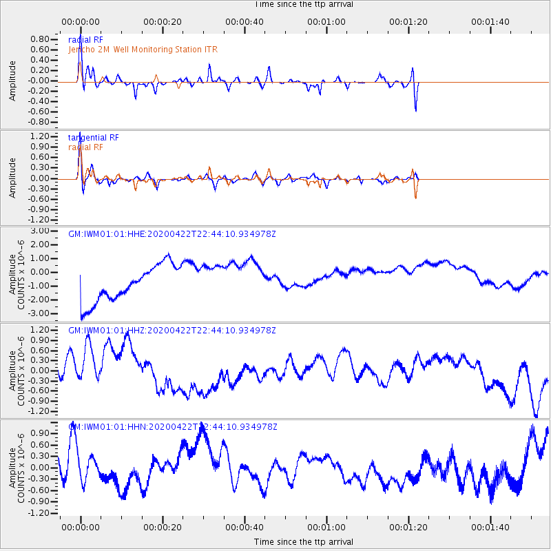
IWM01 Jericho 2M Well Monitoring Station - Earthquake Result Viewer
*The percent match for this event was below the threshold and hence no stack was calculated.
| Earthquake location: |
Tonga Islands Region |
| Earthquake latitude/longitude: |
-22.1/-175.5 |
| Earthquake time(UTC): |
2020/04/22 (113) 22:31:25 GMT |
| Earthquake Depth: |
40 km |
| Earthquake Magnitude: |
5.5 Mww |
| Earthquake Catalog/Contributor: |
NEIC PDE/us |
|
| Network: |
GM US Geological Survey Networks |
| Station: |
IWM01 Jericho 2M Well Monitoring Station |
| Lat/Lon: |
36.73 N/96.53 W |
| Elevation: |
328 m |
|
| Distance: |
94.6 deg |
| Az: |
52.287 deg |
| Baz: |
245.963 deg |
| Ray Param: |
$rayparam |
*The percent match for this event was below the threshold and hence was not used in the summary stack. |
|
| Radial Match: |
63.19626 % |
| Radial Bump: |
371 |
| Transverse Match: |
85.64808 % |
| Transverse Bump: |
351 |
| SOD ConfigId: |
21166931 |
| Insert Time: |
2020-05-06 22:38:54.013 +0000 |
| GWidth: |
2.5 |
| Max Bumps: |
400 |
| Tol: |
0.001 |
|
Signal To Noise
| Channel | StoN | STA | LTA |
| GM:IWM01:01:HHZ:20200422T22:44:10.934978Z | 1.085403 | 9.330185E-7 | 8.596057E-7 |
| GM:IWM01:01:HHN:20200422T22:44:10.934978Z | 0.6249127 | 3.6256526E-7 | 5.801855E-7 |
| GM:IWM01:01:HHE:20200422T22:44:10.934978Z | 0.9809319 | 1.2753552E-6 | 1.3001466E-6 |
| Arrivals |
| Ps | |
| PpPs | |
| PsPs/PpSs | |


