You are here: Home > Network List > US - United States National Seismic Network Stations List
> Station EGMT Eagleton, Montana, USA > Earthquake Result Viewer
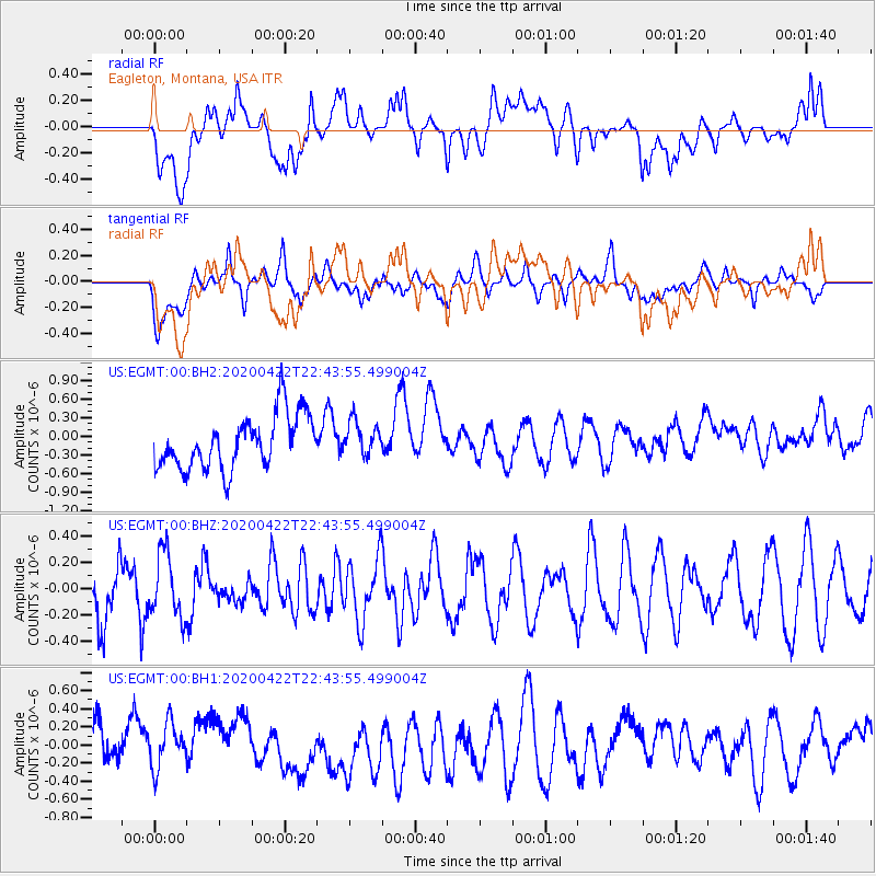
EGMT Eagleton, Montana, USA - Earthquake Result Viewer
*The percent match for this event was below the threshold and hence no stack was calculated.
| Earthquake location: |
Tonga Islands Region |
| Earthquake latitude/longitude: |
-22.1/-175.5 |
| Earthquake time(UTC): |
2020/04/22 (113) 22:31:25 GMT |
| Earthquake Depth: |
40 km |
| Earthquake Magnitude: |
5.5 Mww |
| Earthquake Catalog/Contributor: |
NEIC PDE/us |
|
| Network: |
US United States National Seismic Network |
| Station: |
EGMT Eagleton, Montana, USA |
| Lat/Lon: |
48.02 N/109.75 W |
| Elevation: |
1055 m |
|
| Distance: |
91.2 deg |
| Az: |
37.746 deg |
| Baz: |
237.758 deg |
| Ray Param: |
$rayparam |
*The percent match for this event was below the threshold and hence was not used in the summary stack. |
|
| Radial Match: |
43.620556 % |
| Radial Bump: |
400 |
| Transverse Match: |
42.03466 % |
| Transverse Bump: |
400 |
| SOD ConfigId: |
21166931 |
| Insert Time: |
2020-05-06 22:46:16.408 +0000 |
| GWidth: |
2.5 |
| Max Bumps: |
400 |
| Tol: |
0.001 |
|
Signal To Noise
| Channel | StoN | STA | LTA |
| US:EGMT:00:BHZ:20200422T22:43:55.499004Z | 1.1518991 | 2.4079574E-7 | 2.0904241E-7 |
| US:EGMT:00:BH1:20200422T22:43:55.499004Z | 0.95519096 | 2.5001754E-7 | 2.6174612E-7 |
| US:EGMT:00:BH2:20200422T22:43:55.499004Z | 0.6511903 | 2.8099194E-7 | 4.3150513E-7 |
| Arrivals |
| Ps | |
| PpPs | |
| PsPs/PpSs | |


