You are here: Home > Network List > UW - Pacific Northwest Regional Seismic Network Stations List
> Station FISH Seaside, OR, USA > Earthquake Result Viewer
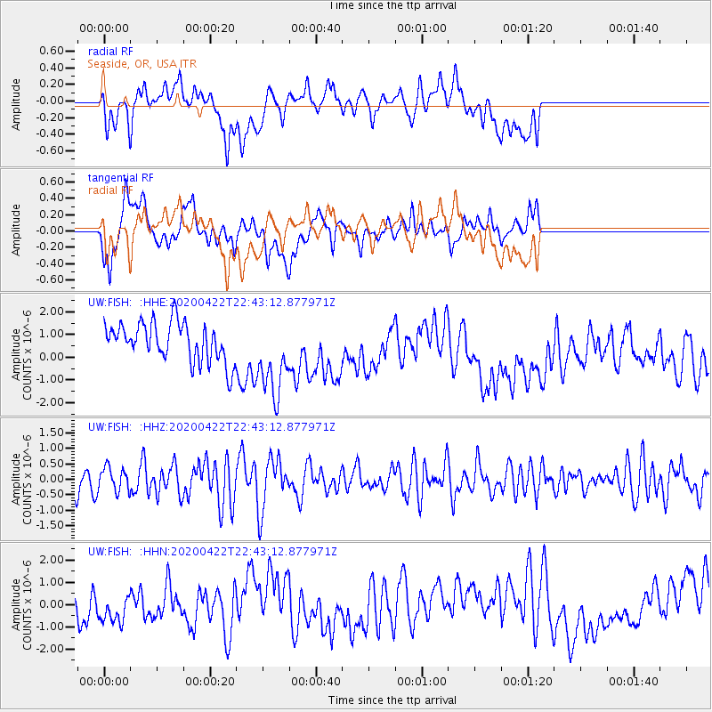
FISH Seaside, OR, USA - Earthquake Result Viewer
*The percent match for this event was below the threshold and hence no stack was calculated.
| Earthquake location: |
Tonga Islands Region |
| Earthquake latitude/longitude: |
-22.1/-175.5 |
| Earthquake time(UTC): |
2020/04/22 (113) 22:31:25 GMT |
| Earthquake Depth: |
40 km |
| Earthquake Magnitude: |
5.5 Mww |
| Earthquake Catalog/Contributor: |
NEIC PDE/us |
|
| Network: |
UW Pacific Northwest Regional Seismic Network |
| Station: |
FISH Seaside, OR, USA |
| Lat/Lon: |
45.93 N/123.56 W |
| Elevation: |
325 m |
|
| Distance: |
82.4 deg |
| Az: |
33.663 deg |
| Baz: |
227.447 deg |
| Ray Param: |
$rayparam |
*The percent match for this event was below the threshold and hence was not used in the summary stack. |
|
| Radial Match: |
18.385015 % |
| Radial Bump: |
400 |
| Transverse Match: |
41.044834 % |
| Transverse Bump: |
400 |
| SOD ConfigId: |
21166931 |
| Insert Time: |
2020-05-06 22:46:53.877 +0000 |
| GWidth: |
2.5 |
| Max Bumps: |
400 |
| Tol: |
0.001 |
|
Signal To Noise
| Channel | StoN | STA | LTA |
| UW:FISH: :HHZ:20200422T22:43:12.877971Z | 0.65067583 | 3.694549E-7 | 5.678018E-7 |
| UW:FISH: :HHN:20200422T22:43:12.877971Z | 1.0149784 | 7.542704E-7 | 7.4313937E-7 |
| UW:FISH: :HHE:20200422T22:43:12.877971Z | 2.1156576 | 1.7968875E-6 | 8.4932816E-7 |
| Arrivals |
| Ps | |
| PpPs | |
| PsPs/PpSs | |


