You are here: Home > Network List > KN - Kyrgyz Seismic Telemetry Network Stations List
> Station CHM KN.CHM > Earthquake Result Viewer
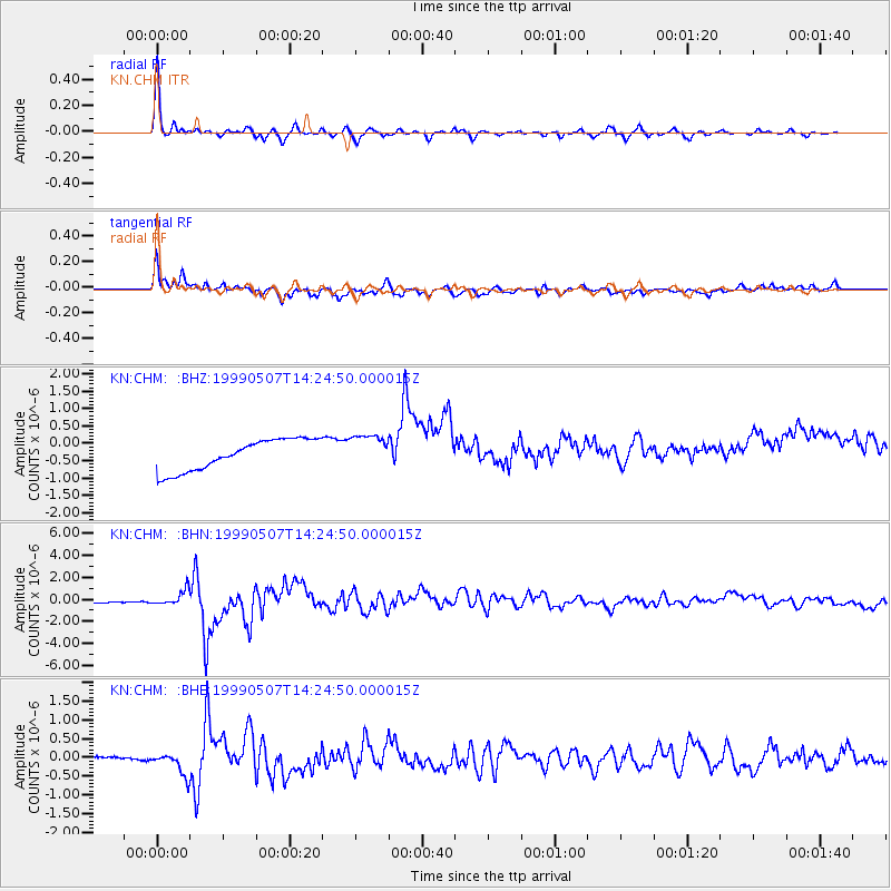
CHM KN.CHM - Earthquake Result Viewer
*The percent match for this event was below the threshold and hence no stack was calculated.
| Earthquake location: |
Kodiak Island Region, Alaska |
| Earthquake latitude/longitude: |
56.4/-152.9 |
| Earthquake time(UTC): |
1999/05/07 (127) 14:13:52 GMT |
| Earthquake Depth: |
20 km |
| Earthquake Magnitude: |
5.7 MB, 6.1 MS, 6.4 MW, 5.7 ME |
| Earthquake Catalog/Contributor: |
WHDF/NEIC |
|
| Network: |
KN Kyrgyz Seismic Telemetry Network |
| Station: |
CHM KN.CHM |
| Lat/Lon: |
43.00 N/74.75 E |
| Elevation: |
655 m |
|
| Distance: |
73.1 deg |
| Az: |
325.459 deg |
| Baz: |
25.436 deg |
| Ray Param: |
$rayparam |
*The percent match for this event was below the threshold and hence was not used in the summary stack. |
|
| Radial Match: |
95.32069 % |
| Radial Bump: |
285 |
| Transverse Match: |
67.15963 % |
| Transverse Bump: |
400 |
| SOD ConfigId: |
4480 |
| Insert Time: |
2010-03-08 19:35:00.511 +0000 |
| GWidth: |
2.5 |
| Max Bumps: |
400 |
| Tol: |
0.001 |
|
Signal To Noise
| Channel | StoN | STA | LTA |
| KN:CHM: :BHN:19990507T14:24:50.000015Z | 2.0295405 | 6.224012E-7 | 3.0667098E-7 |
| KN:CHM: :BHE:19990507T14:24:50.000015Z | 9.007189 | 3.052486E-7 | 3.3889442E-8 |
| KN:CHM: :BHZ:19990507T14:24:50.000015Z | 1.0819744 | 4.836271E-7 | 4.4698572E-7 |
| Arrivals |
| Ps | |
| PpPs | |
| PsPs/PpSs | |


