You are here: Home > Network List > KN - Kyrgyz Seismic Telemetry Network Stations List
> Station CHM KN.CHM > Earthquake Result Viewer
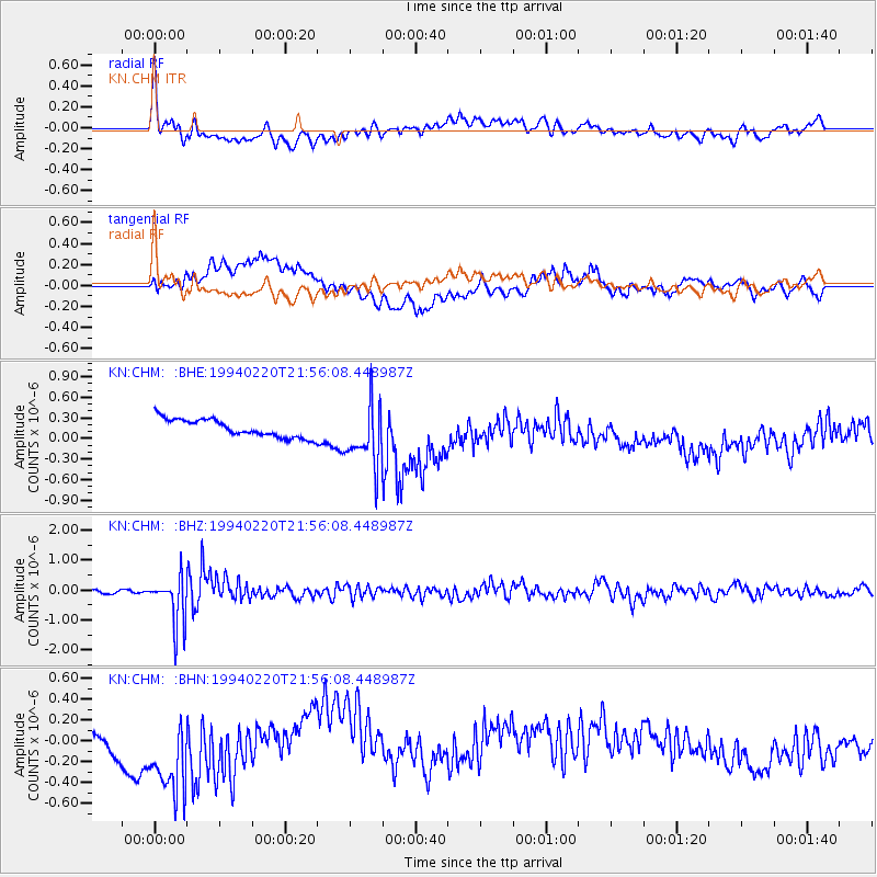
CHM KN.CHM - Earthquake Result Viewer
*The percent match for this event was below the threshold and hence no stack was calculated.
| Earthquake location: |
Mindoro, Philippines |
| Earthquake latitude/longitude: |
13.7/120.8 |
| Earthquake time(UTC): |
1994/02/20 (051) 21:48:13 GMT |
| Earthquake Depth: |
219 km |
| Earthquake Magnitude: |
5.5 MB |
| Earthquake Catalog/Contributor: |
WHDF/NEIC |
|
| Network: |
KN Kyrgyz Seismic Telemetry Network |
| Station: |
CHM KN.CHM |
| Lat/Lon: |
43.00 N/74.75 E |
| Elevation: |
655 m |
|
| Distance: |
49.1 deg |
| Az: |
315.659 deg |
| Baz: |
112.192 deg |
| Ray Param: |
$rayparam |
*The percent match for this event was below the threshold and hence was not used in the summary stack. |
|
| Radial Match: |
66.67108 % |
| Radial Bump: |
400 |
| Transverse Match: |
27.144833 % |
| Transverse Bump: |
400 |
| SOD ConfigId: |
4480 |
| Insert Time: |
2010-03-08 19:35:44.932 +0000 |
| GWidth: |
2.5 |
| Max Bumps: |
400 |
| Tol: |
0.001 |
|
Signal To Noise
| Channel | StoN | STA | LTA |
| KN:CHM: :BHZ:19940220T21:56:08.448987Z | 13.803126 | 8.0137494E-7 | 5.8057495E-8 |
| KN:CHM: :BHN:19940220T21:56:08.448987Z | 3.0191622 | 5.739923E-7 | 1.9011641E-7 |
| KN:CHM: :BHE:19940220T21:56:08.448987Z | 3.3691955 | 4.381784E-7 | 1.300543E-7 |
| Arrivals |
| Ps | |
| PpPs | |
| PsPs/PpSs | |


