You are here: Home > Network List > TA - USArray Transportable Network (new EarthScope stations) Stations List
> Station E20K Nigu River, AK, USA > Earthquake Result Viewer
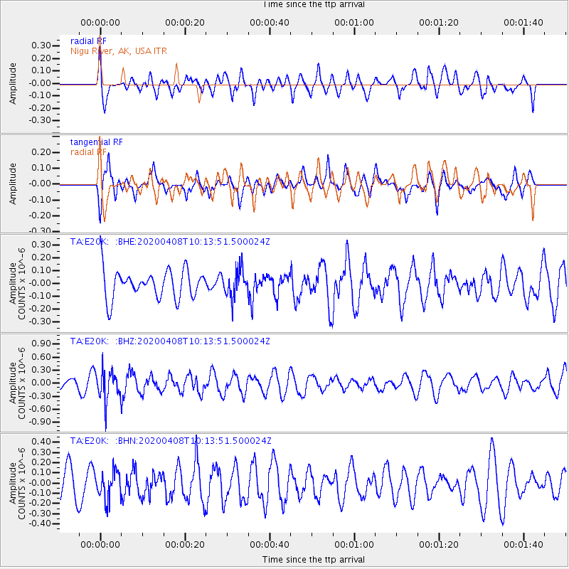
E20K Nigu River, AK, USA - Earthquake Result Viewer
*The percent match for this event was below the threshold and hence no stack was calculated.
| Earthquake location: |
Fiji Islands Region |
| Earthquake latitude/longitude: |
-15.7/-177.6 |
| Earthquake time(UTC): |
2020/04/08 (099) 10:02:32 GMT |
| Earthquake Depth: |
421 km |
| Earthquake Magnitude: |
5.5 Mww |
| Earthquake Catalog/Contributor: |
NEIC PDE/us |
|
| Network: |
TA USArray Transportable Network (new EarthScope stations) |
| Station: |
E20K Nigu River, AK, USA |
| Lat/Lon: |
68.26 N/156.19 W |
| Elevation: |
866 m |
|
| Distance: |
85.1 deg |
| Az: |
7.852 deg |
| Baz: |
200.683 deg |
| Ray Param: |
$rayparam |
*The percent match for this event was below the threshold and hence was not used in the summary stack. |
|
| Radial Match: |
52.03684 % |
| Radial Bump: |
400 |
| Transverse Match: |
58.35448 % |
| Transverse Bump: |
400 |
| SOD ConfigId: |
21166931 |
| Insert Time: |
2020-05-07 11:30:14.103 +0000 |
| GWidth: |
2.5 |
| Max Bumps: |
400 |
| Tol: |
0.001 |
|
Signal To Noise
| Channel | StoN | STA | LTA |
| TA:E20K: :BHZ:20200408T10:13:51.500024Z | 2.2238457 | 3.311213E-7 | 1.4889581E-7 |
| TA:E20K: :BHN:20200408T10:13:51.500024Z | 0.63423294 | 1.3815136E-7 | 2.1782434E-7 |
| TA:E20K: :BHE:20200408T10:13:51.500024Z | 0.969234 | 1.07490564E-7 | 1.1090259E-7 |
| Arrivals |
| Ps | |
| PpPs | |
| PsPs/PpSs | |


