You are here: Home > Network List > TS - TERRAscope (Southern California Seismic Network) Stations List
> Station SBC Santa Barbara, California, USA > Earthquake Result Viewer
SBC Santa Barbara, California, USA - Earthquake Result Viewer
*The percent match for this event was below the threshold and hence no stack was calculated.
| Earthquake location: |
Kuril Islands |
| Earthquake latitude/longitude: |
45.6/149.0 |
| Earthquake time(UTC): |
1991/10/08 (281) 03:31:15 GMT |
| Earthquake Depth: |
147 km |
| Earthquake Magnitude: |
6.0 MB, 5.3 UNKNOWN |
| Earthquake Catalog/Contributor: |
WHDF/NEIC |
|
| Network: |
TS TERRAscope (Southern California Seismic Network) |
| Station: |
SBC Santa Barbara, California, USA |
| Lat/Lon: |
34.44 N/119.71 W |
| Elevation: |
90 m |
|
| Distance: |
67.2 deg |
| Az: |
63.701 deg |
| Baz: |
310.348 deg |
| Ray Param: |
$rayparam |
*The percent match for this event was below the threshold and hence was not used in the summary stack. |
|
| Radial Match: |
55.515892 % |
| Radial Bump: |
400 |
| Transverse Match: |
68.76549 % |
| Transverse Bump: |
400 |
| SOD ConfigId: |
4480 |
| Insert Time: |
2010-02-26 14:48:40.551 +0000 |
| GWidth: |
2.5 |
| Max Bumps: |
400 |
| Tol: |
0.001 |
|
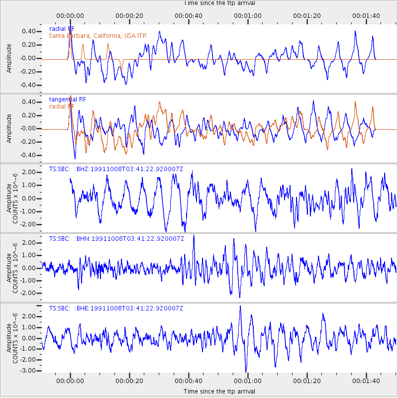
Signal To Noise
| Channel | StoN | STA | LTA |
| TS:SBC: :BHN:19911008T03:41:22.920007Z | 1.2774547 | 5.365474E-7 | 4.200129E-7 |
| TS:SBC: :BHE:19911008T03:41:22.920007Z | 1.144768 | 7.593313E-7 | 6.6330585E-7 |
| TS:SBC: :BHZ:19911008T03:41:22.920007Z | 1.8338392 | 1.4540865E-6 | 7.9291925E-7 |
| Arrivals |
| Ps | |
| PpPs | |
| PsPs/PpSs | |


