You are here: Home > Network List > TX - Texas Seismological Network Stations List
> Station WTFS Witchita Falls > Earthquake Result Viewer
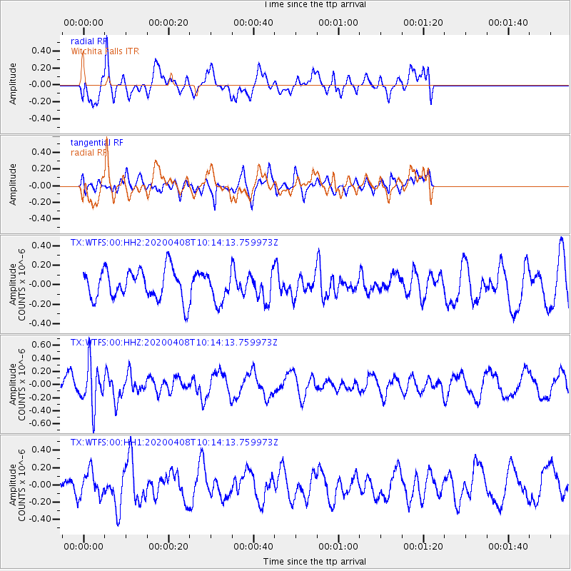
WTFS Witchita Falls - Earthquake Result Viewer
*The percent match for this event was below the threshold and hence no stack was calculated.
| Earthquake location: |
Fiji Islands Region |
| Earthquake latitude/longitude: |
-15.7/-177.6 |
| Earthquake time(UTC): |
2020/04/08 (099) 10:02:32 GMT |
| Earthquake Depth: |
421 km |
| Earthquake Magnitude: |
5.5 Mww |
| Earthquake Catalog/Contributor: |
NEIC PDE/us |
|
| Network: |
TX Texas Seismological Network |
| Station: |
WTFS Witchita Falls |
| Lat/Lon: |
33.77 N/98.46 W |
| Elevation: |
277 m |
|
| Distance: |
89.9 deg |
| Az: |
54.9 deg |
| Baz: |
251.105 deg |
| Ray Param: |
$rayparam |
*The percent match for this event was below the threshold and hence was not used in the summary stack. |
|
| Radial Match: |
57.1463 % |
| Radial Bump: |
400 |
| Transverse Match: |
56.52119 % |
| Transverse Bump: |
400 |
| SOD ConfigId: |
21166931 |
| Insert Time: |
2020-05-07 11:33:38.861 +0000 |
| GWidth: |
2.5 |
| Max Bumps: |
400 |
| Tol: |
0.001 |
|
Signal To Noise
| Channel | StoN | STA | LTA |
| TX:WTFS:00:HHZ:20200408T10:14:13.759973Z | 2.4651523 | 3.1969932E-7 | 1.2968746E-7 |
| TX:WTFS:00:HH1:20200408T10:14:13.759973Z | 1.0067202 | 1.4417763E-7 | 1.432152E-7 |
| TX:WTFS:00:HH2:20200408T10:14:13.759973Z | 0.9960548 | 1.5223522E-7 | 1.5283818E-7 |
| Arrivals |
| Ps | |
| PpPs | |
| PsPs/PpSs | |


