You are here: Home > Network List > KN - Kyrgyz Seismic Telemetry Network Stations List
> Station CHM KN.CHM > Earthquake Result Viewer
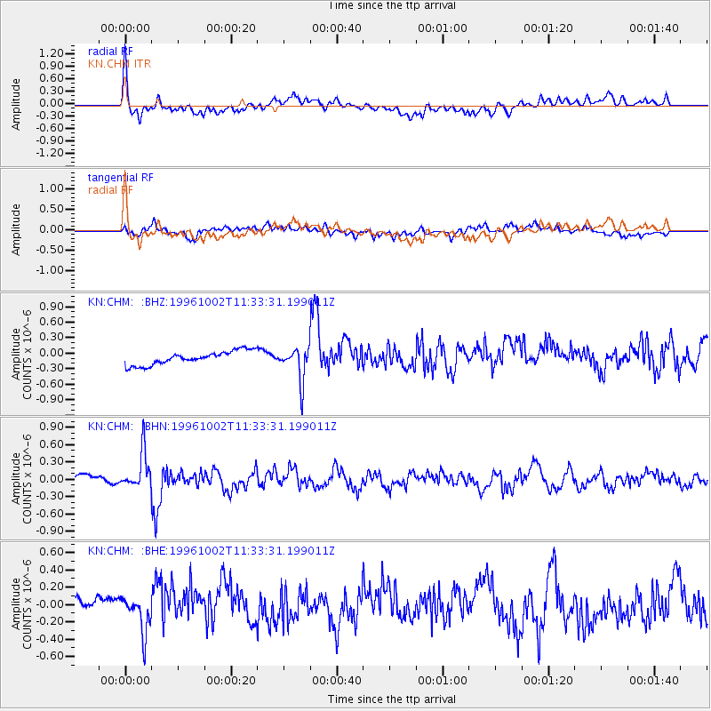
CHM KN.CHM - Earthquake Result Viewer
*The percent match for this event was below the threshold and hence no stack was calculated.
| Earthquake location: |
Kuril Islands |
| Earthquake latitude/longitude: |
45.1/151.2 |
| Earthquake time(UTC): |
1996/10/02 (276) 11:24:48 GMT |
| Earthquake Depth: |
33 km |
| Earthquake Magnitude: |
6.1 MB, 5.4 MS, 6.0 UNKNOWN, 6.0 MW |
| Earthquake Catalog/Contributor: |
WHDF/NEIC |
|
| Network: |
KN Kyrgyz Seismic Telemetry Network |
| Station: |
CHM KN.CHM |
| Lat/Lon: |
43.00 N/74.75 E |
| Elevation: |
655 m |
|
| Distance: |
53.0 deg |
| Az: |
296.74 deg |
| Baz: |
59.501 deg |
| Ray Param: |
$rayparam |
*The percent match for this event was below the threshold and hence was not used in the summary stack. |
|
| Radial Match: |
76.3026 % |
| Radial Bump: |
400 |
| Transverse Match: |
65.16029 % |
| Transverse Bump: |
400 |
| SOD ConfigId: |
4480 |
| Insert Time: |
2010-03-08 19:36:11.535 +0000 |
| GWidth: |
2.5 |
| Max Bumps: |
400 |
| Tol: |
0.001 |
|
Signal To Noise
| Channel | StoN | STA | LTA |
| KN:CHM: :BHN:19961002T11:33:31.199011Z | 6.119037 | 3.2080553E-7 | 5.2427453E-8 |
| KN:CHM: :BHE:19961002T11:33:31.199011Z | 1.4487065 | 1.9774883E-7 | 1.3650028E-7 |
| KN:CHM: :BHZ:19961002T11:33:31.199011Z | 2.4678366 | 3.240364E-7 | 1.3130382E-7 |
| Arrivals |
| Ps | |
| PpPs | |
| PsPs/PpSs | |


