You are here: Home > Network List > KN - Kyrgyz Seismic Telemetry Network Stations List
> Station CHM KN.CHM > Earthquake Result Viewer
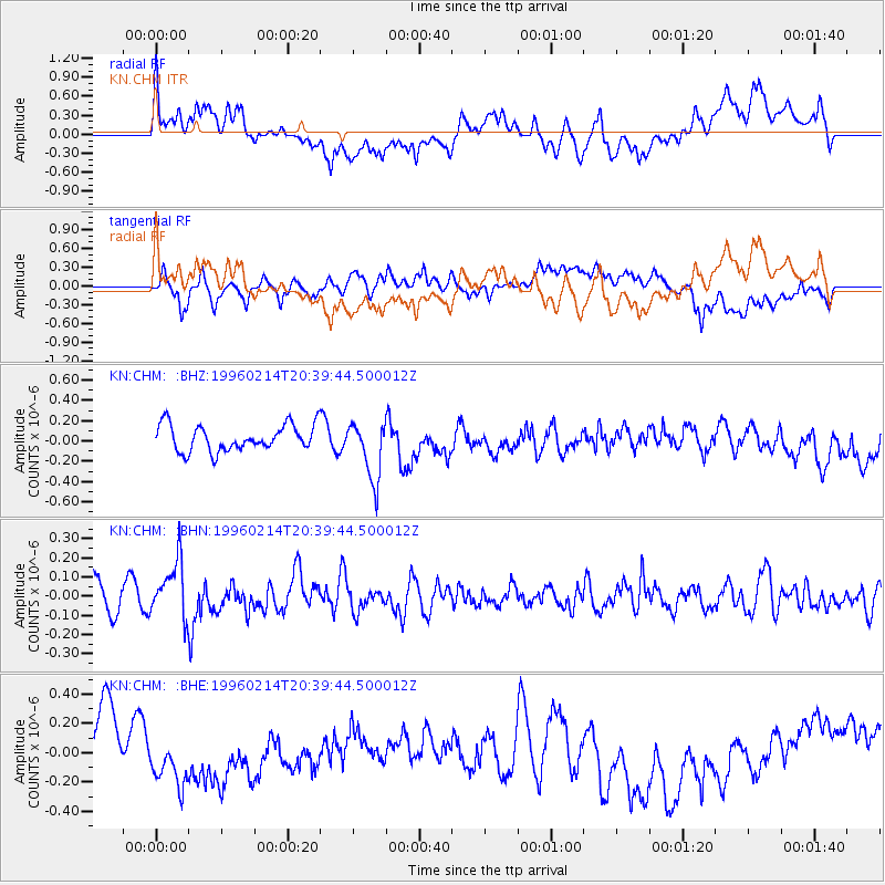
CHM KN.CHM - Earthquake Result Viewer
*The percent match for this event was below the threshold and hence no stack was calculated.
| Earthquake location: |
Kuril Islands |
| Earthquake latitude/longitude: |
45.4/150.4 |
| Earthquake time(UTC): |
1996/02/14 (045) 20:31:06 GMT |
| Earthquake Depth: |
33 km |
| Earthquake Magnitude: |
5.9 MB, 5.2 MS, 5.8 UNKNOWN, 5.8 MW |
| Earthquake Catalog/Contributor: |
WHDF/NEIC |
|
| Network: |
KN Kyrgyz Seismic Telemetry Network |
| Station: |
CHM KN.CHM |
| Lat/Lon: |
43.00 N/74.75 E |
| Elevation: |
655 m |
|
| Distance: |
52.4 deg |
| Az: |
296.189 deg |
| Baz: |
59.536 deg |
| Ray Param: |
$rayparam |
*The percent match for this event was below the threshold and hence was not used in the summary stack. |
|
| Radial Match: |
47.83848 % |
| Radial Bump: |
400 |
| Transverse Match: |
56.395496 % |
| Transverse Bump: |
400 |
| SOD ConfigId: |
4480 |
| Insert Time: |
2010-03-08 19:36:14.989 +0000 |
| GWidth: |
2.5 |
| Max Bumps: |
400 |
| Tol: |
0.001 |
|
Signal To Noise
| Channel | StoN | STA | LTA |
| KN:CHM: :BHN:19960214T20:39:44.500012Z | 2.5297136 | 1.4782185E-7 | 5.843422E-8 |
| KN:CHM: :BHE:19960214T20:39:44.500012Z | 0.61787015 | 1.4507283E-7 | 2.34795E-7 |
| KN:CHM: :BHZ:19960214T20:39:44.500012Z | 2.2803228 | 2.9333947E-7 | 1.2863946E-7 |
| Arrivals |
| Ps | |
| PpPs | |
| PsPs/PpSs | |


