You are here: Home > Network List > KN - Kyrgyz Seismic Telemetry Network Stations List
> Station CHM KN.CHM > Earthquake Result Viewer
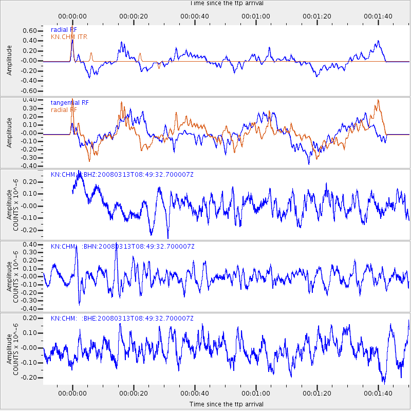
CHM KN.CHM - Earthquake Result Viewer
*The percent match for this event was below the threshold and hence no stack was calculated.
| Earthquake location: |
Kuril Islands |
| Earthquake latitude/longitude: |
43.1/146.5 |
| Earthquake time(UTC): |
2008/03/13 (073) 08:41:07 GMT |
| Earthquake Depth: |
53 km |
| Earthquake Magnitude: |
5.6 MB, 5.4 MW, 5.3 MW |
| Earthquake Catalog/Contributor: |
WHDF/NEIC |
|
| Network: |
KN Kyrgyz Seismic Telemetry Network |
| Station: |
CHM KN.CHM |
| Lat/Lon: |
43.00 N/74.75 E |
| Elevation: |
655 m |
|
| Distance: |
50.9 deg |
| Az: |
296.134 deg |
| Baz: |
63.739 deg |
| Ray Param: |
$rayparam |
*The percent match for this event was below the threshold and hence was not used in the summary stack. |
|
| Radial Match: |
53.50418 % |
| Radial Bump: |
400 |
| Transverse Match: |
68.61822 % |
| Transverse Bump: |
400 |
| SOD ConfigId: |
2504 |
| Insert Time: |
2010-03-08 19:36:20.292 +0000 |
| GWidth: |
2.5 |
| Max Bumps: |
400 |
| Tol: |
0.001 |
|
Signal To Noise
| Channel | StoN | STA | LTA |
| KN:CHM: :BHN:20080313T08:49:32.700007Z | 1.838543 | 1.7202062E-7 | 9.356356E-8 |
| KN:CHM: :BHE:20080313T08:49:32.700007Z | 1.6765101 | 8.713252E-8 | 5.197256E-8 |
| KN:CHM: :BHZ:20080313T08:49:32.700007Z | 0.9601192 | 1.0168724E-7 | 1.0591106E-7 |
| Arrivals |
| Ps | |
| PpPs | |
| PsPs/PpSs | |


