You are here: Home > Network List > UW - Pacific Northwest Regional Seismic Network Stations List
> Station IRON Crane, OR, USA > Earthquake Result Viewer
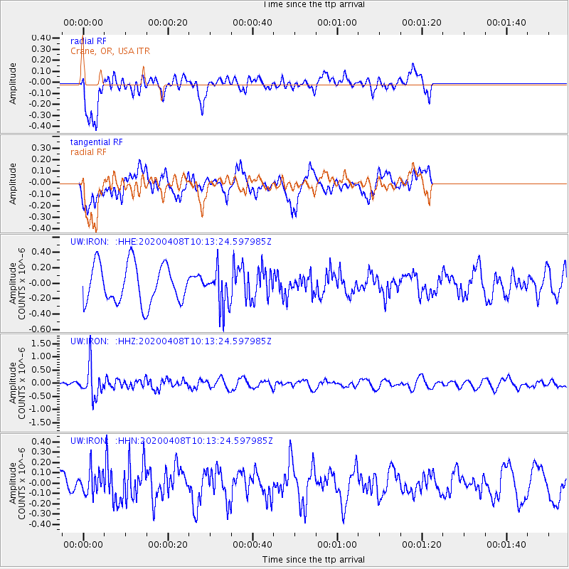
IRON Crane, OR, USA - Earthquake Result Viewer
*The percent match for this event was below the threshold and hence no stack was calculated.
| Earthquake location: |
Fiji Islands Region |
| Earthquake latitude/longitude: |
-15.7/-177.6 |
| Earthquake time(UTC): |
2020/04/08 (099) 10:02:32 GMT |
| Earthquake Depth: |
421 km |
| Earthquake Magnitude: |
5.5 Mww |
| Earthquake Catalog/Contributor: |
NEIC PDE/us |
|
| Network: |
UW Pacific Northwest Regional Seismic Network |
| Station: |
IRON Crane, OR, USA |
| Lat/Lon: |
43.36 N/118.47 W |
| Elevation: |
1226 m |
|
| Distance: |
79.8 deg |
| Az: |
39.505 deg |
| Baz: |
237.161 deg |
| Ray Param: |
$rayparam |
*The percent match for this event was below the threshold and hence was not used in the summary stack. |
|
| Radial Match: |
45.15145 % |
| Radial Bump: |
400 |
| Transverse Match: |
59.204338 % |
| Transverse Bump: |
400 |
| SOD ConfigId: |
21166931 |
| Insert Time: |
2020-05-07 11:35:57.267 +0000 |
| GWidth: |
2.5 |
| Max Bumps: |
400 |
| Tol: |
0.001 |
|
Signal To Noise
| Channel | StoN | STA | LTA |
| UW:IRON: :HHZ:20200408T10:13:24.597985Z | 3.84261 | 5.827941E-7 | 1.5166621E-7 |
| UW:IRON: :HHN:20200408T10:13:24.597985Z | 0.71024287 | 1.1744639E-7 | 1.6536089E-7 |
| UW:IRON: :HHE:20200408T10:13:24.597985Z | 0.9601718 | 2.4113754E-7 | 2.5114E-7 |
| Arrivals |
| Ps | |
| PpPs | |
| PsPs/PpSs | |


