You are here: Home > Network List > KN - Kyrgyz Seismic Telemetry Network Stations List
> Station CHM KN.CHM > Earthquake Result Viewer
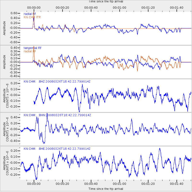
CHM KN.CHM - Earthquake Result Viewer
*The percent match for this event was below the threshold and hence no stack was calculated.
| Earthquake location: |
Kuril Islands |
| Earthquake latitude/longitude: |
46.4/153.0 |
| Earthquake time(UTC): |
2008/03/26 (086) 18:33:34 GMT |
| Earthquake Depth: |
17 km |
| Earthquake Magnitude: |
5.5 MB, 5.2 MS, 5.6 MW, 5.5 MW |
| Earthquake Catalog/Contributor: |
WHDF/NEIC |
|
| Network: |
KN Kyrgyz Seismic Telemetry Network |
| Station: |
CHM KN.CHM |
| Lat/Lon: |
43.00 N/74.75 E |
| Elevation: |
655 m |
|
| Distance: |
53.5 deg |
| Az: |
296.744 deg |
| Baz: |
57.347 deg |
| Ray Param: |
$rayparam |
*The percent match for this event was below the threshold and hence was not used in the summary stack. |
|
| Radial Match: |
37.37813 % |
| Radial Bump: |
400 |
| Transverse Match: |
48.553894 % |
| Transverse Bump: |
400 |
| SOD ConfigId: |
2504 |
| Insert Time: |
2010-03-08 19:36:22.549 +0000 |
| GWidth: |
2.5 |
| Max Bumps: |
400 |
| Tol: |
0.001 |
|
Signal To Noise
| Channel | StoN | STA | LTA |
| KN:CHM: :BHN:20080326T18:42:22.799014Z | 4.6033106 | 2.184067E-7 | 4.744557E-8 |
| KN:CHM: :BHE:20080326T18:42:22.799014Z | 2.110984 | 1.3115093E-7 | 6.212787E-8 |
| KN:CHM: :BHZ:20080326T18:42:22.799014Z | 2.106062 | 1.5059621E-7 | 7.150607E-8 |
| Arrivals |
| Ps | |
| PpPs | |
| PsPs/PpSs | |


