You are here: Home > Network List > GS - US Geological Survey Networks Stations List
> Station DEC05 Decatur Surface Seismic Site, Decatur, IL, USA > Earthquake Result Viewer
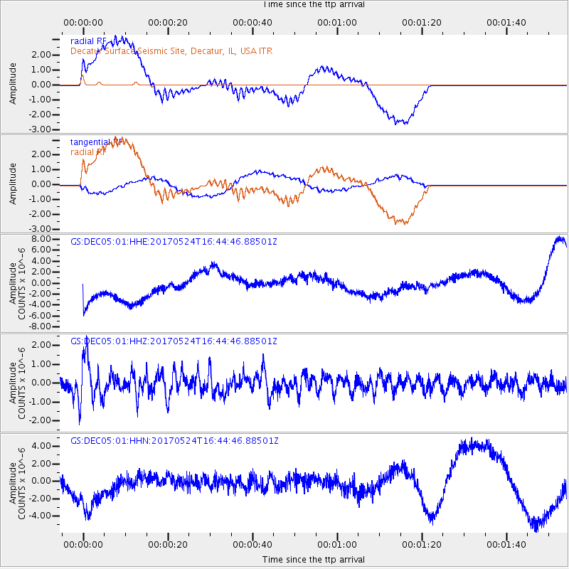
DEC05 Decatur Surface Seismic Site, Decatur, IL, USA - Earthquake Result Viewer
*The percent match for this event was below the threshold and hence no stack was calculated.
| Earthquake location: |
Fox Islands, Aleutian Islands |
| Earthquake latitude/longitude: |
52.4/-166.7 |
| Earthquake time(UTC): |
2017/05/24 (144) 16:36:01 GMT |
| Earthquake Depth: |
2.0 km |
| Earthquake Magnitude: |
5.7 Mi |
| Earthquake Catalog/Contributor: |
NEIC PDE/at |
|
| Network: |
GS US Geological Survey Networks |
| Station: |
DEC05 Decatur Surface Seismic Site, Decatur, IL, USA |
| Lat/Lon: |
39.87 N/88.87 W |
| Elevation: |
216 m |
|
| Distance: |
52.8 deg |
| Az: |
70.738 deg |
| Baz: |
311.302 deg |
| Ray Param: |
$rayparam |
*The percent match for this event was below the threshold and hence was not used in the summary stack. |
|
| Radial Match: |
34.74687 % |
| Radial Bump: |
400 |
| Transverse Match: |
39.491566 % |
| Transverse Bump: |
400 |
| SOD ConfigId: |
2028011 |
| Insert Time: |
2017-06-07 16:39:20.292 +0000 |
| GWidth: |
2.5 |
| Max Bumps: |
400 |
| Tol: |
0.001 |
|
Signal To Noise
| Channel | StoN | STA | LTA |
| GS:DEC05:01:HHZ:20170524T16:44:46.88501Z | 5.6034226 | 1.1609211E-6 | 2.071807E-7 |
| GS:DEC05:01:HHN:20170524T16:44:46.88501Z | 3.4959054 | 3.7490631E-6 | 1.0724156E-6 |
| GS:DEC05:01:HHE:20170524T16:44:46.88501Z | 3.320269 | 4.5381794E-6 | 1.3668107E-6 |
| Arrivals |
| Ps | |
| PpPs | |
| PsPs/PpSs | |


