You are here: Home > Network List > KN - Kyrgyz Seismic Telemetry Network Stations List
> Station CHM KN.CHM > Earthquake Result Viewer
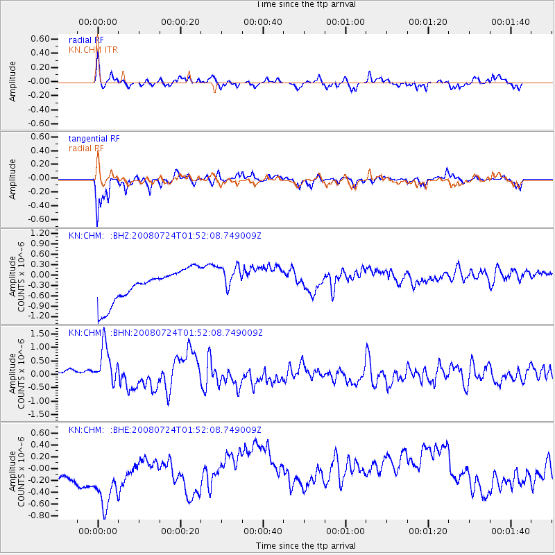
CHM KN.CHM - Earthquake Result Viewer
*The percent match for this event was below the threshold and hence no stack was calculated.
| Earthquake location: |
Kuril Islands |
| Earthquake latitude/longitude: |
51.0/157.6 |
| Earthquake time(UTC): |
2008/07/24 (206) 01:43:16 GMT |
| Earthquake Depth: |
27 km |
| Earthquake Magnitude: |
6.0 MB, 6.0 MS, 6.2 MW, 6.2 MW |
| Earthquake Catalog/Contributor: |
WHDF/NEIC |
|
| Network: |
KN Kyrgyz Seismic Telemetry Network |
| Station: |
CHM KN.CHM |
| Lat/Lon: |
43.00 N/74.75 E |
| Elevation: |
655 m |
|
| Distance: |
54.2 deg |
| Az: |
296.237 deg |
| Baz: |
50.632 deg |
| Ray Param: |
$rayparam |
*The percent match for this event was below the threshold and hence was not used in the summary stack. |
|
| Radial Match: |
56.814114 % |
| Radial Bump: |
337 |
| Transverse Match: |
68.4286 % |
| Transverse Bump: |
363 |
| SOD ConfigId: |
2504 |
| Insert Time: |
2010-03-08 19:36:43.374 +0000 |
| GWidth: |
2.5 |
| Max Bumps: |
400 |
| Tol: |
0.001 |
|
Signal To Noise
| Channel | StoN | STA | LTA |
| KN:CHM: :BHN:20080724T01:52:08.749009Z | 2.2425761 | 9.275622E-7 | 4.1361457E-7 |
| KN:CHM: :BHE:20080724T01:52:08.749009Z | 1.5841508 | 9.361311E-7 | 5.9093554E-7 |
| KN:CHM: :BHZ:20080724T01:52:08.749009Z | 0.90888053 | 4.1617056E-7 | 4.5789358E-7 |
| Arrivals |
| Ps | |
| PpPs | |
| PsPs/PpSs | |


