You are here: Home > Network List > GS - US Geological Survey Networks Stations List
> Station OK051 E0350 and S34600 Roads, Ralston, OK > Earthquake Result Viewer
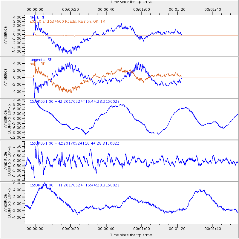
OK051 E0350 and S34600 Roads, Ralston, OK - Earthquake Result Viewer
*The percent match for this event was below the threshold and hence no stack was calculated.
| Earthquake location: |
Fox Islands, Aleutian Islands |
| Earthquake latitude/longitude: |
52.4/-166.7 |
| Earthquake time(UTC): |
2017/05/24 (144) 16:36:01 GMT |
| Earthquake Depth: |
2.0 km |
| Earthquake Magnitude: |
5.7 Mi |
| Earthquake Catalog/Contributor: |
NEIC PDE/at |
|
| Network: |
GS US Geological Survey Networks |
| Station: |
OK051 E0350 and S34600 Roads, Ralston, OK |
| Lat/Lon: |
36.51 N/96.84 W |
| Elevation: |
263 m |
|
| Distance: |
50.4 deg |
| Az: |
79.253 deg |
| Baz: |
311.685 deg |
| Ray Param: |
$rayparam |
*The percent match for this event was below the threshold and hence was not used in the summary stack. |
|
| Radial Match: |
69.99097 % |
| Radial Bump: |
400 |
| Transverse Match: |
79.49763 % |
| Transverse Bump: |
400 |
| SOD ConfigId: |
2028011 |
| Insert Time: |
2017-06-07 16:39:47.034 +0000 |
| GWidth: |
2.5 |
| Max Bumps: |
400 |
| Tol: |
0.001 |
|
Signal To Noise
| Channel | StoN | STA | LTA |
| GS:OK051:00:HHZ:20170524T16:44:28.315002Z | 3.9875062 | 9.3884387E-7 | 2.3544638E-7 |
| GS:OK051:00:HH1:20170524T16:44:28.315002Z | 3.457983 | 5.927773E-6 | 1.7142285E-6 |
| GS:OK051:00:HH2:20170524T16:44:28.315002Z | 1.1376696 | 6.2833005E-6 | 5.5229575E-6 |
| Arrivals |
| Ps | |
| PpPs | |
| PsPs/PpSs | |


